drawing, print, paper, ink, engraving
#
drawing
#
medieval
#
dutch-golden-age
# print
#
pen sketch
#
paper
#
ink
#
geometric
#
cityscape
#
engraving
Dimensions: height 235 mm, width 312 mm
Copyright: Rijks Museum: Open Domain
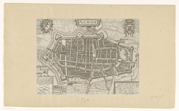
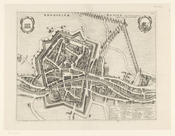
Curator: Here we have "Plattegrond van de stad Utrecht," a cityscape rendered in ink on paper dating sometime between 1612 and 1648. What are your initial thoughts? Editor: I'm struck by the incredible detail and precision, especially given the likely tools available at the time. There is an implied tension between the pastoral setting and this need to map every square inch in minute, geometric perfection. It’s a bit uncanny. Curator: The engraving reveals the city as an ordered space, each building block and street meticulously planned. The lines articulate a grid system imposed on the landscape. Consider, too, the two crests in the upper corners, almost heraldic in their presentation. These frame the inscription TRAJECTVM. Editor: Absolutely, this order stands in stark contrast to what daily life must have been like then. Looking at the lines used to represent dwellings and waterways—the labor needed to produce this precise rendering is considerable. Think of the tools: the pens, the ink... the source of that ink, the conditions of the paper-making. It recontextualizes our understanding of urban development, doesn't it? Curator: The etching technique further emphasizes structure. Lines create form and depth. Note, for instance, how strategic hatch-marks delineate texture while simultaneously adhering to an almost mathematical, geometrical clarity. We’re not just looking at a picture but engaging with an abstracted urban reality, defined through lines and spatial relationships. Editor: Exactly. This "reality," however, came from human hands utilizing resources, and shaped by sociopolitical conditions of urban spaces and defense systems. You see people sketched on the outskirts there – the suggestion of commerce, movement and work that drove that meticulous ordering process from its start to finish. I'm drawn to those liminal human touches around this map; they offer perspective to how cartography isn't solely a geometrical abstraction. Curator: That’s an excellent point. Perhaps its value resides precisely in that tension – between rigid formalism and humanistic grounding, making it less an objective document and more a historical construction. Editor: It reveals a dialogue between representation and tangible effort. Reflecting on the time, place, and hands involved enhances its geometrical mastery.
Comments
No comments
Be the first to comment and join the conversation on the ultimate creative platform.
More like this