print, etching, architecture
# print
#
etching
#
landscape
#
etching
#
geometric
#
cityscape
#
architecture
Dimensions: height 277 mm, width 342 mm
Copyright: Rijks Museum: Open Domain
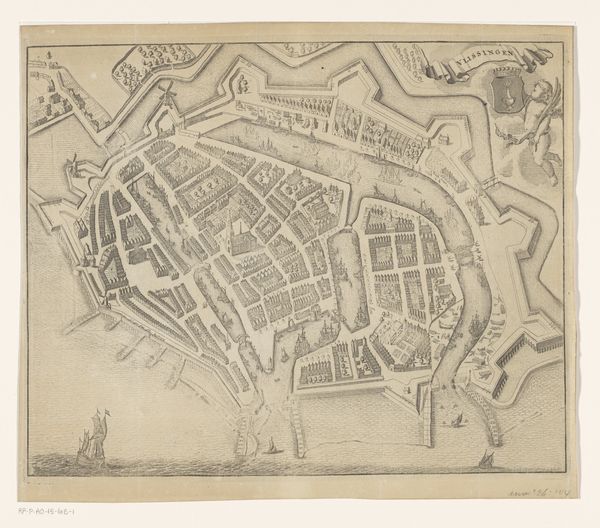
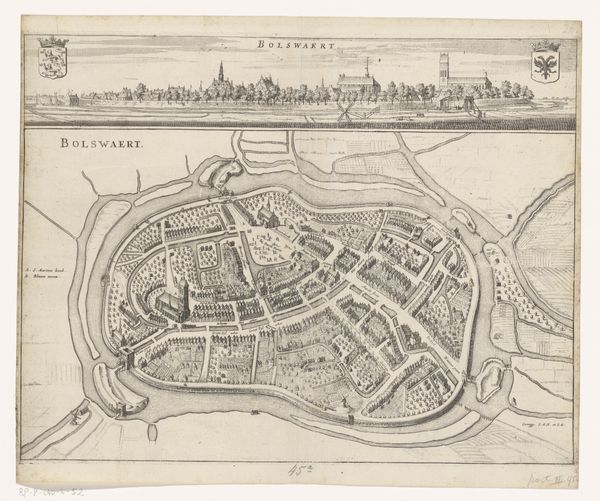
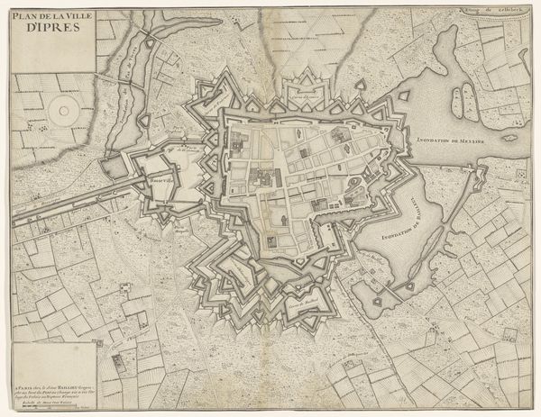
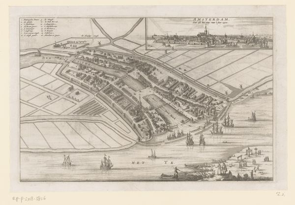
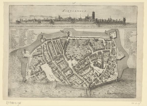
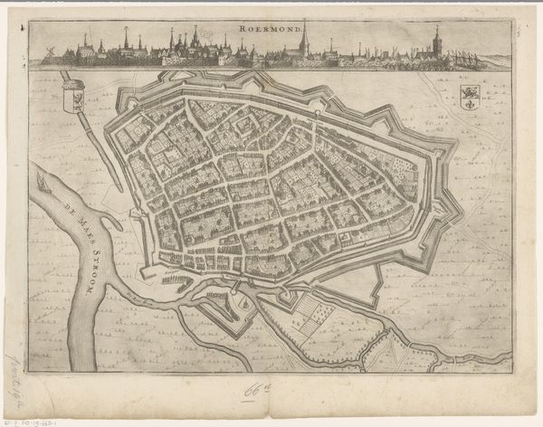
Editor: Here we have "Plattegrond van Veere," an etching from between 1696 and 1728 by an anonymous artist, at the Rijksmuseum. It's a fascinatingly detailed bird's eye view, but there’s almost a sense of… enforced order to it. It feels very planned, not organic. What do you see in this piece, especially regarding any deeper meanings? Curator: The key here lies in recognizing that these cityscapes were not just about geographic accuracy. They functioned as potent symbols. Maps were endorsements, displaying not only land but power and authority. Note how the fortifications dominate; what psychological effect might this image have had on viewers – both within and outside the city? Editor: That's interesting. I hadn’t really considered it beyond just being a map. So the layout itself, the emphasis on defense, that speaks to a cultural anxiety, or a need for control? Curator: Precisely. The grid-like organization within the walls, too, reflects a societal desire for order and predictability, mirroring perhaps the broader cultural shifts of the era. Consider also the relatively small size of buildings when compared to the fortifications: an architectural projection of power? It projects an aspirational idea more than practical geography. What continuities from these urban imprints persist today? Editor: It does make me wonder what aspects are embellished versus what was strictly there for the viewer. So it's about layers of symbolism working together. I’ll certainly think about maps in a completely new light now! Curator: Exactly! A cultural mirror etched in ink. It really exemplifies how even seemingly objective representations are loaded with subjective and culturally specific information.
Comments
No comments
Be the first to comment and join the conversation on the ultimate creative platform.
More like this