print, engraving
#
baroque
# print
#
geometric
#
engraving
Dimensions: height 159 mm, width 229 mm
Copyright: Rijks Museum: Open Domain
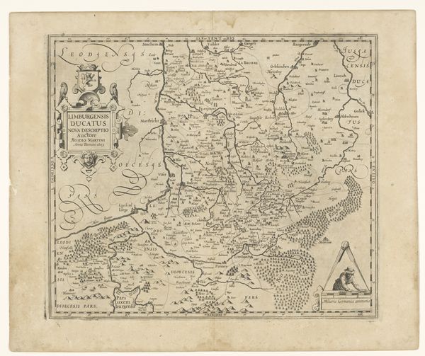
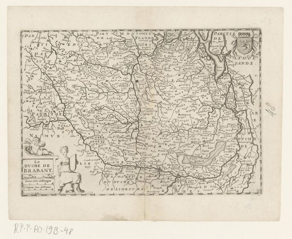
Curator: Looking at this print, the dense network of lines and archaic lettering immediately makes me think of secrets and hidden knowledge. Editor: You’re right, there's a certain mystique. We are standing before an early map titled "Kaart van het hertogdom Limburg," a baroque engraving probably dating from around 1635 to 1696. The Rijksmuseum holds it today. I am struck by how it frames spatial representation with overtly political markers. The cherubs, cartouches... it speaks to power and ownership. Curator: Precisely. Consider the cherubs. They're not just decorative; they're symbolic custodians of territory, classical allusions indicating a cultivated authority staking its claim on the land. The land is rendered as a precious thing to be charted and delineated with precision, something to be possessed. Editor: And I am interested in the message that such depictions send to the world: What this region looks like to those in control. How towns are positioned and identified, who the political allies or targets are, this can serve as a document and guide for military campaigns, trade expeditions... Curator: Indeed, these weren't made in isolation. The map is a visual rhetoric shaped by the complex interplay of social needs and artistic vision. How would this "objective" tool shape self-perception and collective identity, not to mention affect geopolitical strategies? Editor: Certainly, it reinforces existing power structures and imposes a very specific way of seeing, but it also provided some standardization for geographical knowledge and fostered a certain level of visual literacy within a specific audience, for a time at least. Curator: Yet despite the rigid grids and defined boundaries, an older magic lingers for me, the emotional and psychological resonances that maps continue to carry for us. It’s the act of placing ourselves within that carefully constructed space, looking for signs and symbolic significance. Editor: I think understanding the map within the political and artistic context is a useful, critical entry point. Thanks for sharing your insights on this anonymous artwork, Curator. Curator: And thank you for offering an incisive historic lens for decoding this artifact.
Comments
No comments
Be the first to comment and join the conversation on the ultimate creative platform.
More like this