print, etching, engraving
# print
#
etching
#
landscape
#
geometric
#
history-painting
#
engraving
Dimensions: height 332 mm, width 389 mm
Copyright: Rijks Museum: Open Domain
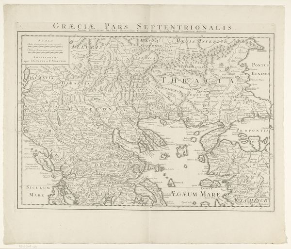
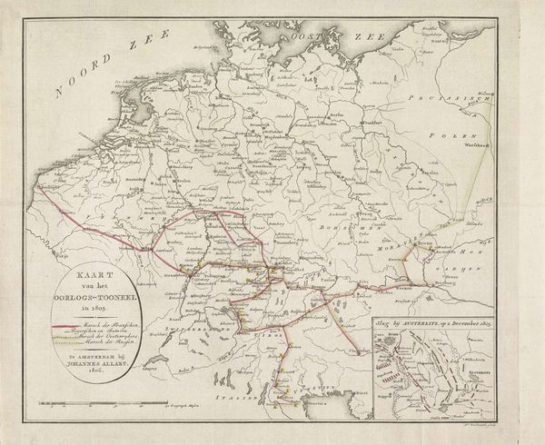
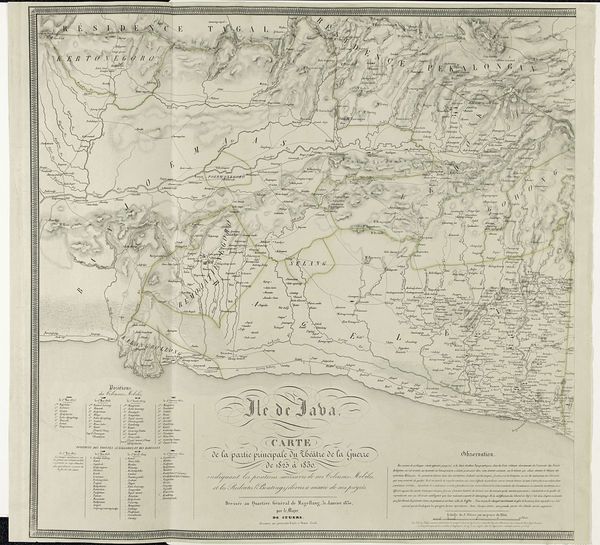
Curator: Here we have “Kaart van het oorlogsterrein van Zuid-Frankrijk en Noord-Italië in 1859,” a map etched and engraved by H. Scheve, dating back to 1859. Editor: Oh, what a remarkably restrained palette for a war zone! I feel a sort of... calculated serenity emanating from the print; ironic, considering its subject matter. It reminds me of quiet anticipation. Curator: Precisely. Note the calculated precision with which Scheve renders topographical details. Observe the contrasting textures denoting terrain—the smooth expanse of the sea versus the hatched lines delineating mountainous regions. This offers insight into how such spaces were conceptually grasped and controlled. Editor: Absolutely. And it makes you consider what wasn't mapped or quantifiable: the smells of that war, the panic in the fields, the terror, the sheer exhaustion. It is absent, though clearly implicit. Almost like an early GPS, directing historical actions on some human scale. Curator: Consider, too, the symbolism inherent in mapmaking itself. It serves not merely as a record, but as an instrument of power, a visual assertion of dominion over territory, deployed using particular geometric codes. The visual objects have definite meaning. Editor: I’m thinking about the tiny squiggles indicating borders—those invisible fences people will die over. So much contained in a fragile etching. This historical moment, presented as a calm declarative object is still, on its own, an oddity. I wonder if Scheve ever sensed the pathos embedded in cartography. Curator: One might argue, considering semiotics and structuralism, the objective nature of mapmaking deliberately disavows the very human pathos of conflict...a strategic omission of its own variety, even its own aesthetic. Editor: Well, looking at it, I think maybe sometimes serenity holds a darker history than bombast, right? It almost leaves a haunting echo where, you might expect roaring canons, but the image leaves its viewers something far deeper. A chance for their own self-reflection.
Comments
No comments
Be the first to comment and join the conversation on the ultimate creative platform.
More like this