graphic-art, print, etching
#
graphic-art
#
baroque
#
dutch-golden-age
# print
#
etching
#
landscape
#
etching
#
cityscape
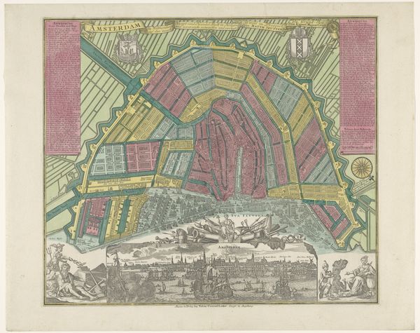
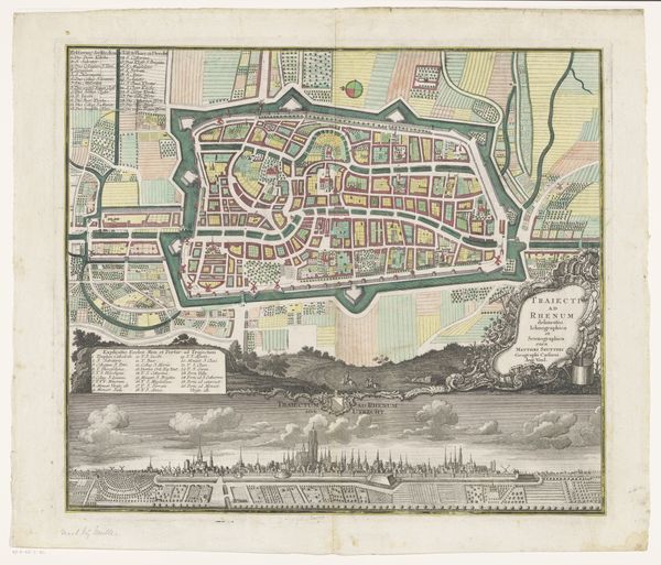
Dimensions: height 483 mm, width 583 mm
Copyright: Rijks Museum: Open Domain
This detailed map of Amsterdam, of unknown date, showcases the city's layout through the traditional craft of engraving, enhanced by delicate hand-coloring. The map's visual impact relies on the engraver’s skillful manipulation of line and tone, creating a compelling image of urban space. The linear precision and clarity with which the city’s waterways, streets, and buildings are rendered, required immense technical skill, and manual dexterity. This would have been incredibly laborious work, and its degree of elaboration speaks volumes about the value placed on artisanal skill. The process of printing multiple copies from a single plate also speaks to the changing economy of image production. This wasn't just about art; it was about information, commerce, and civic pride, all mediated by the engraver’s hand and the printing press. Paying attention to these aspects of making and context allows us to see this map not only as a representation of Amsterdam, but also as a product of its time.
Comments
No comments
Be the first to comment and join the conversation on the ultimate creative platform.
More like this