#
natural stone pattern
#
rippled sketch texture
#
aged paper
#
naturalistic pattern
#
toned paper
#
woodcut effect
#
pattern background
#
linocut print
#
pattern repetition
#
layered pattern
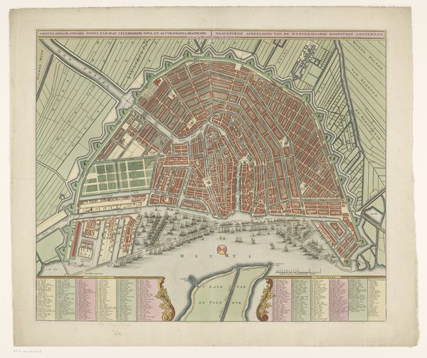
Dimensions: height 505 mm, width 588 mm
Copyright: Rijks Museum: Open Domain
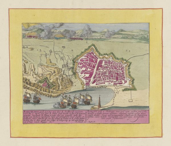
This is an anonymous print of Amsterdam, whose date is unknown, presented as both map and cityscape. The most striking element is the aerial view of Amsterdam itself, segmented into blocks of pink, green, and yellow, each separated by the blue veins of its canals. This colorful abstraction gives way to a detailed, monochromatic prospect of the city's skyline, complete with ships and architectural landmarks. The map, through its ordered, color-coded structure, implies a controlled, navigable space while the inclusion of cityscapes introduce a sense of lived reality, contrasting the abstract with the concrete. This interplay can be viewed through the lens of semiotics. The map uses colors and lines as signs, encoding geographical information into a visual language. The panoramic view below grounds this abstract representation in the actual, physical experience of the city. The map is a cultural artifact that oscillates between objective representation and subjective interpretation. Its lasting appeal lies in this dynamic interplay, inviting us to question how we perceive and represent the spaces we inhabit.
Comments
No comments
Be the first to comment and join the conversation on the ultimate creative platform.
More like this