print, etching, engraving
dutch-golden-age
etching
landscape
etching
geometric
cityscape
engraving
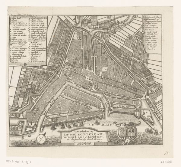
Dimensions: height 409 mm, width 490 mm
Copyright: Rijks Museum: Open Domain
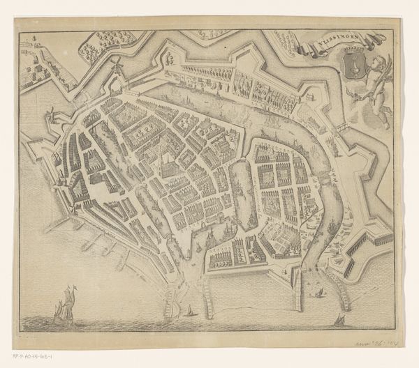
Editor: So, here we have "Plattegrond van Rotterdam," an etching and engraving, dating from sometime between 1733 and 1792, made by an anonymous artist. The incredible detail really struck me – you can almost imagine bustling city life despite it being a sort of bird's-eye view. What stands out to you when you look at this piece? Curator: Ah, yes, my dear. It's more than just a map, isn’t it? Look at the geometric precision of the layout—the gridded fields transitioning into the organized chaos of the city center. To me, it whispers of the Dutch Golden Age's obsession with order and control over their environment, wouldn't you agree? It's also a narrative—of land reclaimed, of a city strategically built for trade and defense. Notice the elaborate fortifications. Almost theatrical, really. Does the way the artist merged cartographic accuracy with artistic flair remind you of anything? Editor: The detail does feel very considered, not just informational. The ships lined up, almost like parade floats, gives me a sense of the city's pride. But what about that strict grid – does that also speak to the constraints of the time? Curator: Constraints and possibilities! They built a global empire from this small, carefully plotted land. It speaks of a resourceful ambition—a very Dutch alchemy, wouldn't you say? Look how water is woven into the whole thing - defence, transport, even aesthetics. It really is a portrait of a society. A silent symphony played out on paper. I wonder, looking at this, can you sense the invisible energy, the hopes, dreams, and tensions of the people who once walked those streets? Editor: That’s an amazing thought. It feels so static at first glance, but knowing it’s capturing a moment in time, filled with real people... it shifts everything. Curator: Exactly. It's not just about the lines on the page; it's about breathing life into history, isn’t it?
Comments
No comments
Be the first to comment and join the conversation on the ultimate creative platform.