print, engraving
#
baroque
# print
#
cityscape
#
history-painting
#
engraving
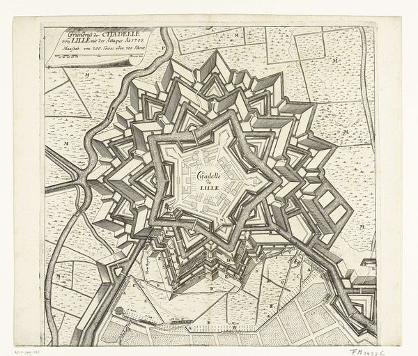
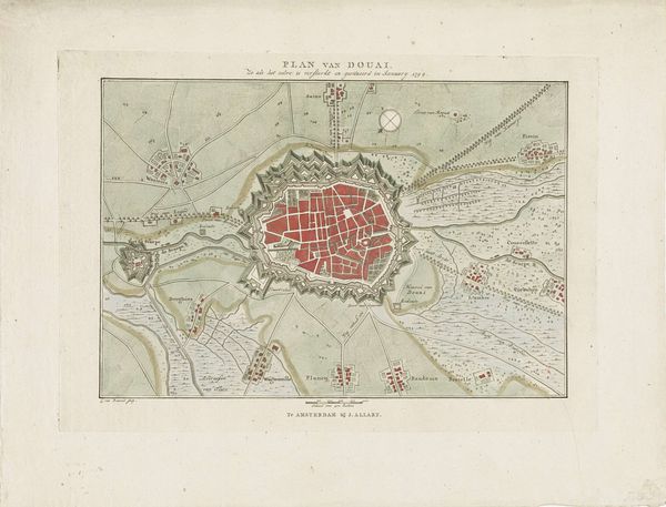
Dimensions: height 498 mm, width 590 mm
Copyright: Rijks Museum: Open Domain
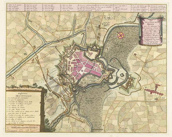
This is a 1710 map of Béthune, rendered by an anonymous hand. Note the city's fortifications, laid out in a star-like pattern. This wasn’t merely for defense; it echoed the sunburst motifs we find in royal emblems, symbolizing power radiating outward. Consider how the star, a symbol of guidance and destiny, is here transformed into a tool of military might. We find echoes of this in Renaissance city plans, or even in religious mandalas, where geometric shapes represent cosmic order. Yet, here, the sacred geometry serves a more earthly purpose: control. It’s a fascinating case of how symbols can be secularized, repurposed. The psychological effect is profound: even a map can become a powerful statement of dominance, engaging our subconscious anxieties about safety and order. This emblem didn't vanish with time; it reemerges, shaped and reshaped, a testament to our enduring need for symbols of power.
Comments
No comments
Be the first to comment and join the conversation on the ultimate creative platform.
More like this