drawing, print, paper, engraving
#
drawing
#
baroque
# print
#
landscape
#
paper
#
architectural drawing
#
cityscape
#
engraving
Dimensions: height 300 mm, width 390 mm
Copyright: Rijks Museum: Open Domain
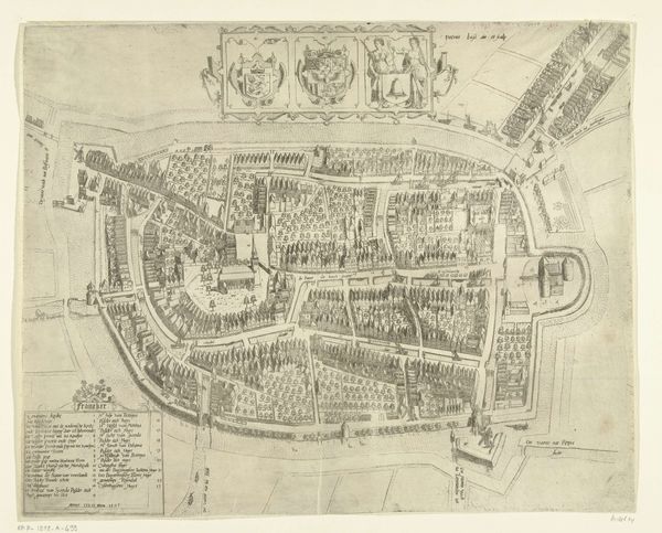
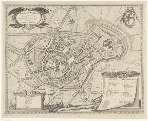
Here is a map of Breda, made by B.F. Immink using etching. It's not dated, but we can assume that this plan of the Dutch city captures a specific moment in its urban and social development. The circular layout, surrounded by fortifications, is very telling. In early modern Europe, cities were not just places of commerce but also strategic military assets. The map’s emphasis on defensive structures – walls, moats, gates – speaks volumes about the ever-present threat of conflict and siege in the Netherlands during this period. The presence of religious institutions like ‘Het Nonne Klosifer’, or nunnery, and the named streets such as ‘De Kerk Straat’, or church street, also gives us clues about the social and cultural life of Breda. How does the distribution of these sites reflect the power dynamics within the city? To understand this map fully, we would need to delve into the archives of Breda itself, and of other Dutch cities of the time, examining civic records, military reports, and religious documents.
Comments
No comments
Be the first to comment and join the conversation on the ultimate creative platform.
More like this