drawing, print, ink, engraving
#
drawing
#
baroque
# print
#
landscape
#
ink
#
geometric
#
cityscape
#
northern-renaissance
#
engraving
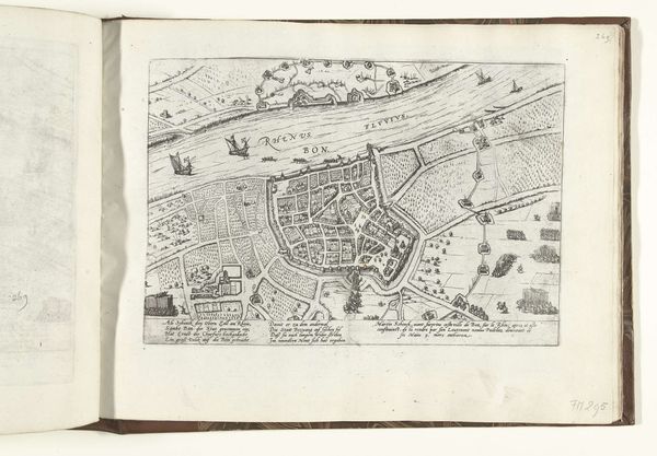
Dimensions: height 375 mm, width 505 mm
Copyright: Rijks Museum: Open Domain
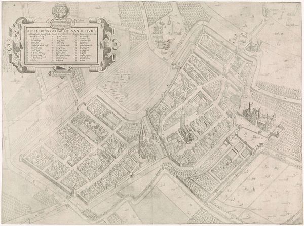
Hendrik Jansz. Verstraelen created this geometrically precise map of Culemborg. This detailed plan of Culemborg is more than just a geographical document; it's a window into the social and political landscape of the Netherlands. Created most likely in the 17th century, a period marked by Dutch innovation in cartography and a burgeoning sense of national identity, the map reflects the era’s emphasis on order, control, and the scientific understanding of space. The precision with which the city is rendered—the neat arrangement of houses, the strategic placement of fortifications, and the clear demarcation of fields—speaks to the values of a society that was rapidly urbanizing and expanding its global reach. To fully understand this artwork, one must delve into the archives and libraries of the Netherlands, exploring historical records and scholarly analyses of Dutch cartography. This map offers an entry point into understanding the intricate interplay of art, science, and society.
Comments
No comments
Be the first to comment and join the conversation on the ultimate creative platform.
More like this