About this artwork
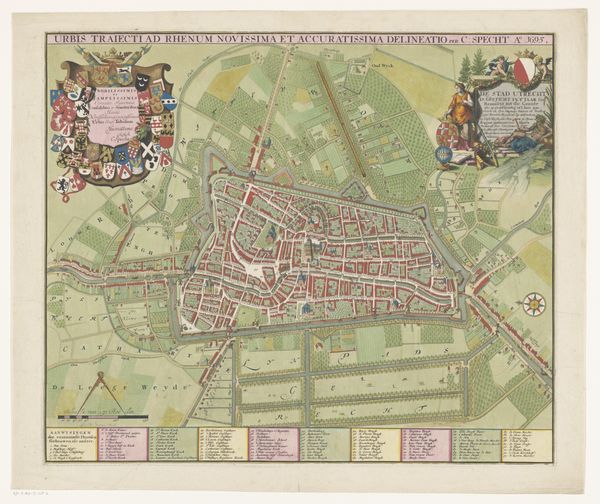
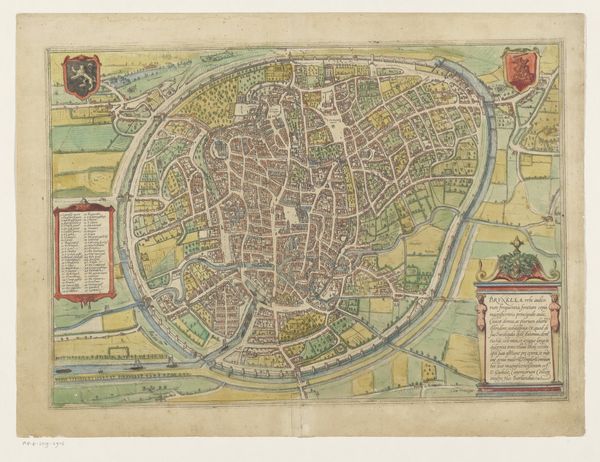
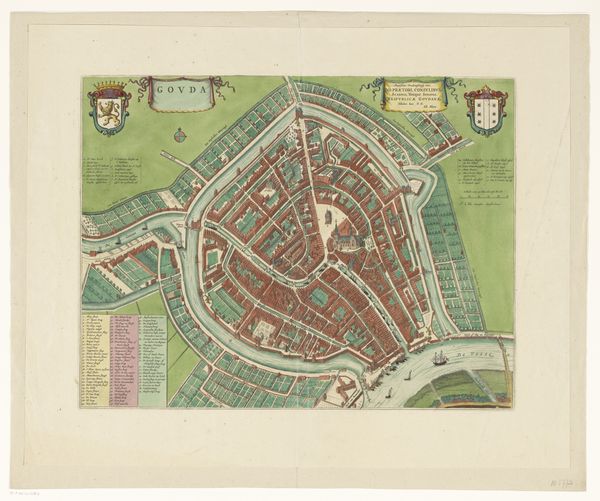
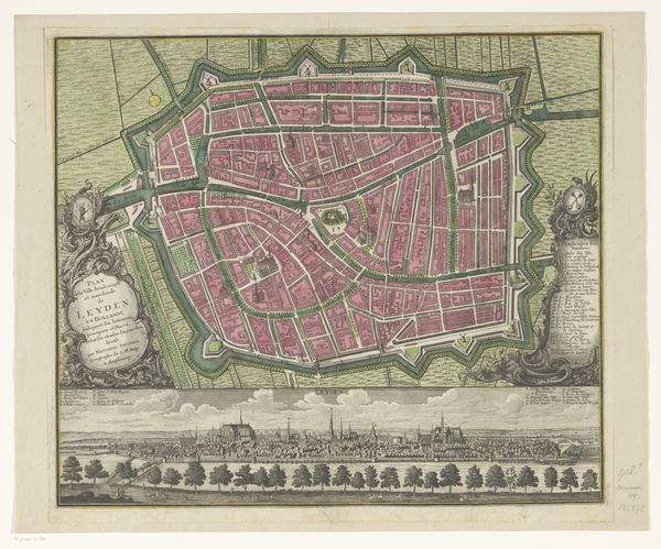
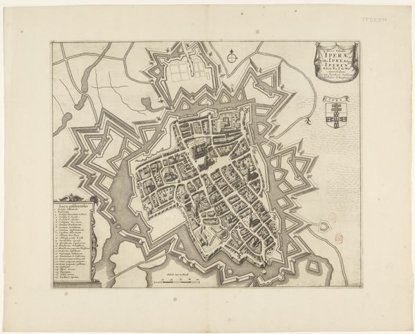
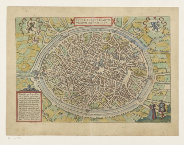
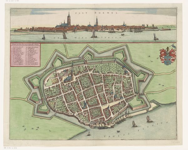
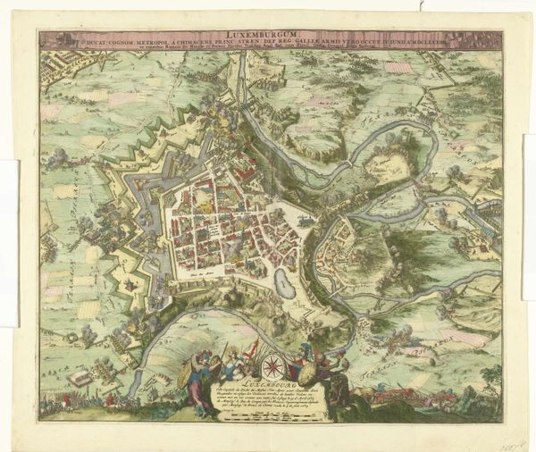
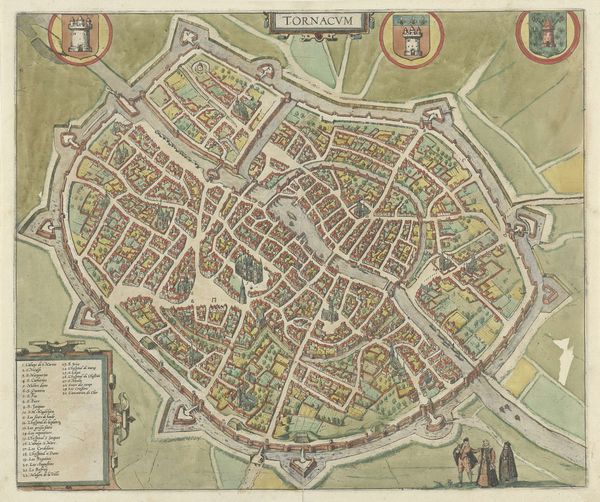
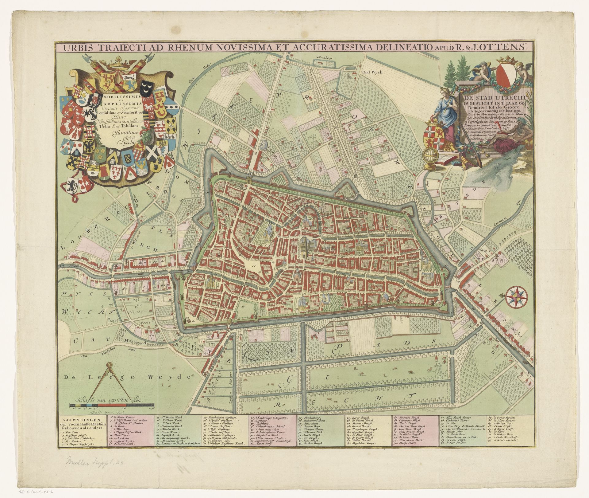
Curator: Let's consider this print, "Plattegrond van de stad Utrecht," dating from between 1695 and 1750 and created by Jan van Vianen. I am immediately drawn to the process of its creation. How many different laborers do you think were involved in making something like this? Editor: That's a fascinating question. My first impression was simply how beautiful it is – the detail, the colors – it gives such a vivid sense of the city. But now that you mention it, the physical production... How would they even begin to create a map of this scale, then reproduce it like this? Curator: Precisely! Consider the copperplate etching involved. Who mined the copper? Who shaped it? Who engraved the image onto the plate? And then, who operated the printing press to make these multiples? The layering of inks, the types of paper... Each decision reflects a particular set of materials and processes. The print becomes less about *representing* Utrecht and more about *materializing* the city through labor. How do these thoughts change your view of the image? Editor: I suppose it moves it from being just a pretty image to an actual artifact of its time, produced under specific conditions and by the hands of numerous people we'll probably never know. It also suggests a certain level of investment in depicting the city this way - maybe for trade, military, or even propaganda purposes? Curator: Absolutely. Its function within society is critical to consider. Was it for landowners, merchants, or the military? What power did this kind of representation of space offer them? It transforms our understanding of art beyond the individual genius of the artist and acknowledges the wider networks that create the art object. Editor: This completely changes my perspective. It encourages you to think beyond the image itself and towards the complex networks of production, labor, and materials that brought it into existence.
Artwork details
- Medium
- graphic-art, print
- Dimensions
- height 486 mm, width 573 mm
- Location
- Rijksmuseum
- Copyright
- Rijks Museum: Open Domain
Tags
Comments
Share your thoughts
About this artwork
Curator: Let's consider this print, "Plattegrond van de stad Utrecht," dating from between 1695 and 1750 and created by Jan van Vianen. I am immediately drawn to the process of its creation. How many different laborers do you think were involved in making something like this? Editor: That's a fascinating question. My first impression was simply how beautiful it is – the detail, the colors – it gives such a vivid sense of the city. But now that you mention it, the physical production... How would they even begin to create a map of this scale, then reproduce it like this? Curator: Precisely! Consider the copperplate etching involved. Who mined the copper? Who shaped it? Who engraved the image onto the plate? And then, who operated the printing press to make these multiples? The layering of inks, the types of paper... Each decision reflects a particular set of materials and processes. The print becomes less about *representing* Utrecht and more about *materializing* the city through labor. How do these thoughts change your view of the image? Editor: I suppose it moves it from being just a pretty image to an actual artifact of its time, produced under specific conditions and by the hands of numerous people we'll probably never know. It also suggests a certain level of investment in depicting the city this way - maybe for trade, military, or even propaganda purposes? Curator: Absolutely. Its function within society is critical to consider. Was it for landowners, merchants, or the military? What power did this kind of representation of space offer them? It transforms our understanding of art beyond the individual genius of the artist and acknowledges the wider networks that create the art object. Editor: This completely changes my perspective. It encourages you to think beyond the image itself and towards the complex networks of production, labor, and materials that brought it into existence.
Comments
Share your thoughts