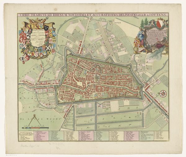
graphic-art, print, paper, engraving
#
graphic-art
#
dutch-golden-age
# print
#
landscape
#
paper
#
cityscape
#
engraving
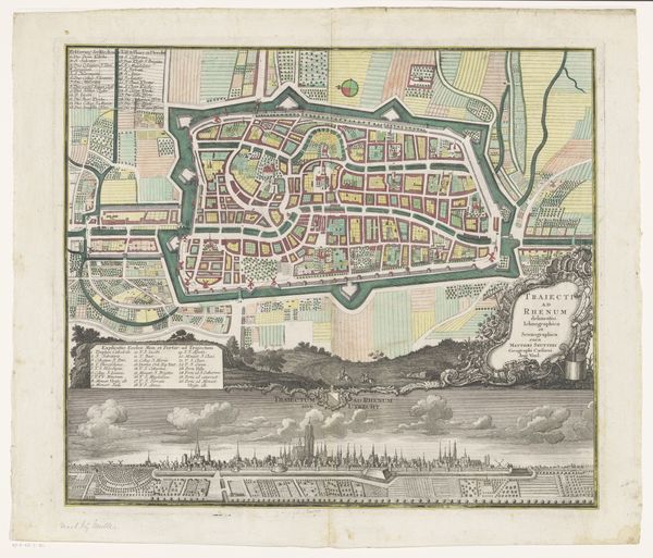
Dimensions: height 489 mm, width 578 mm
Copyright: Rijks Museum: Open Domain
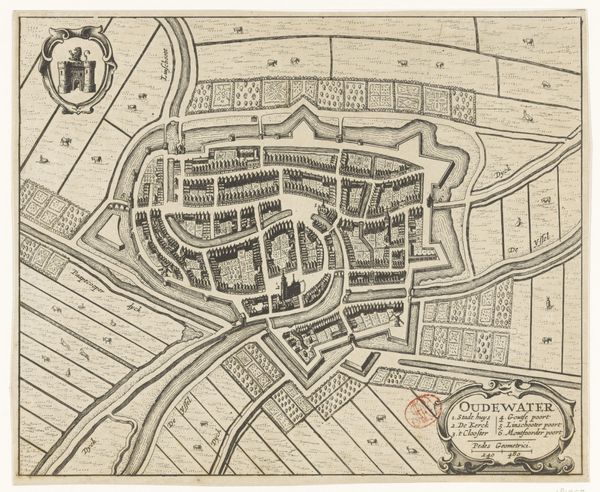
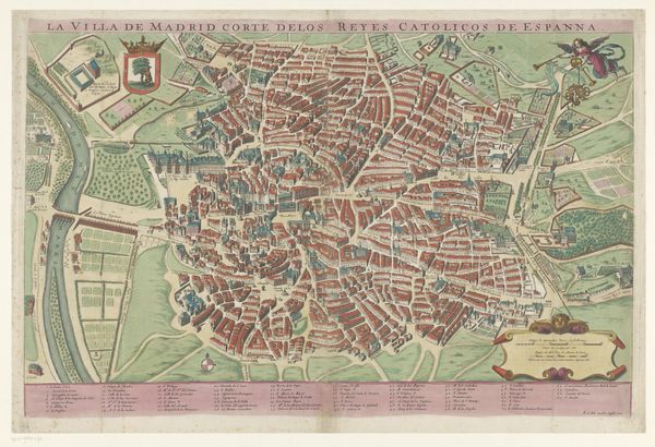
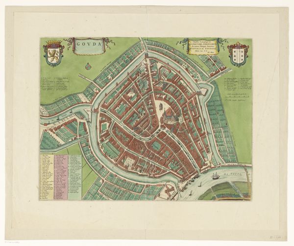
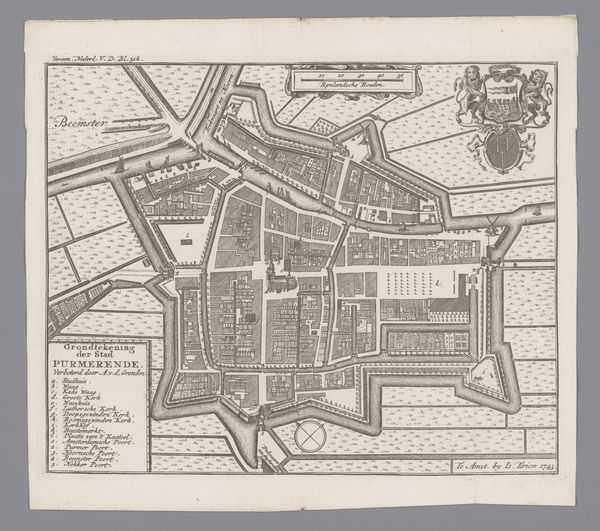
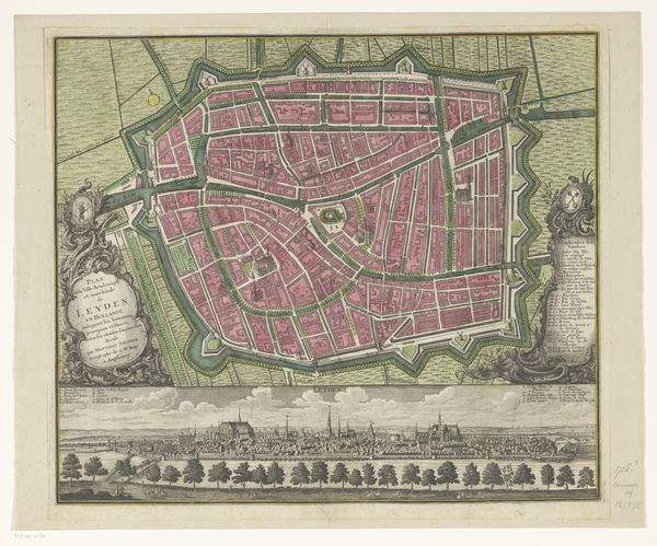
This is a map of Utrecht, created around 1695, offering us a bird's-eye view of the city and its surroundings during the Dutch Golden Age. It's more than just a geographical representation; it reflects the cultural and social values of the time. The map's visual codes, like the detailed depiction of buildings and streets, suggest an emphasis on order and control, very characteristic of the 17th-century Dutch Republic. The inclusion of coats of arms signifies the importance of civic pride and the power of local elites. This was a period of economic prosperity and expansion for the Netherlands. The map offers insight into the social structures of the time, from urban planning to the institutions that governed daily life. To understand it better, we would need to research the history of cartography, civic governance, and the social history of Utrecht, using sources from archives, libraries, and historical societies. Art like this helps us understand how the social context shapes its production and reception.
Comments
No comments
Be the first to comment and join the conversation on the ultimate creative platform.
More like this