About this artwork
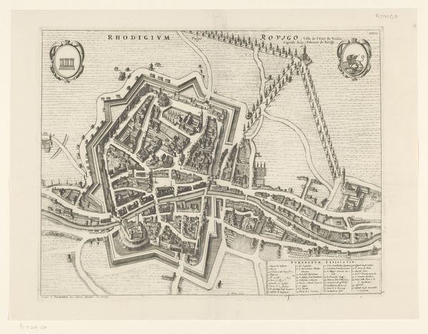
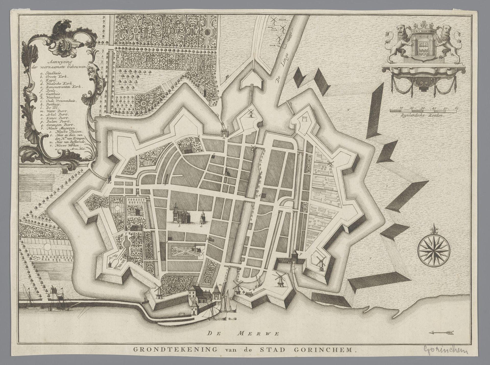
This is an undated map of Gorinchem, created by an anonymous artist. During the early modern period, cities were not only centers of commerce and culture but also reflections of political power and social hierarchies. This map offers us a glimpse into the strategic importance of Gorinchem, evident in its detailed fortifications designed for defense. But it is more than just a layout of streets and buildings; it’s a representation of a society structured by class, religion, and military concerns. Consider how the prominent placement of churches and administrative buildings signifies the influence of religious and governmental institutions. Each element of the map is a testament to the values and priorities of its time, revealing how urban spaces were carefully shaped to mirror and reinforce existing power structures. The emotional weight of such planning, where every line and boundary signifies control and order, invites us to reflect on the lives lived within this carefully constructed space.
Artwork details
- Medium
- print, engraving
- Dimensions
- height 258 mm, width 348 mm
- Copyright
- Rijks Museum: Open Domain
Tags
Comments
Share your thoughts
About this artwork
This is an undated map of Gorinchem, created by an anonymous artist. During the early modern period, cities were not only centers of commerce and culture but also reflections of political power and social hierarchies. This map offers us a glimpse into the strategic importance of Gorinchem, evident in its detailed fortifications designed for defense. But it is more than just a layout of streets and buildings; it’s a representation of a society structured by class, religion, and military concerns. Consider how the prominent placement of churches and administrative buildings signifies the influence of religious and governmental institutions. Each element of the map is a testament to the values and priorities of its time, revealing how urban spaces were carefully shaped to mirror and reinforce existing power structures. The emotional weight of such planning, where every line and boundary signifies control and order, invites us to reflect on the lives lived within this carefully constructed space.
Comments
Share your thoughts