print, engraving
#
dutch-golden-age
# print
#
landscape
#
geometric
#
engraving
#
regionalism
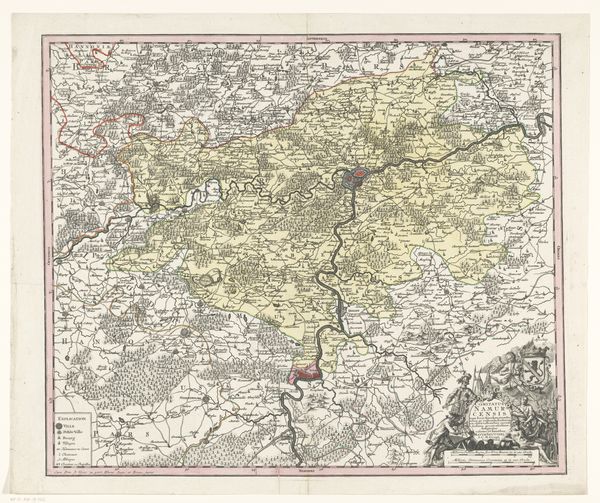
Dimensions: height 479 mm, width 580 mm
Copyright: Rijks Museum: Open Domain
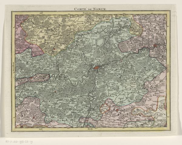
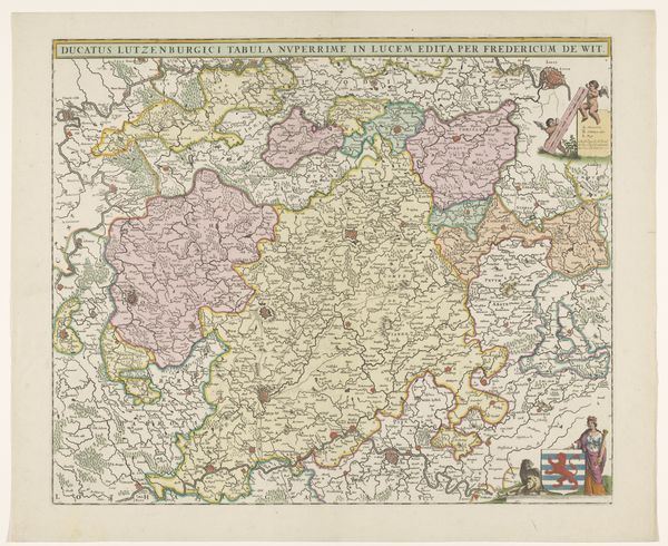
Curator: Welcome! Before us hangs an engraved print titled “Kaart van het graafschap Namen,” or “Map of the County of Namur.” Created by an anonymous artist sometime between 1645 and 1706, it provides a detailed view of the Namur region. Editor: Immediately striking is its pale, almost pastel palette, lending the county a deceptively serene aura. It’s like gazing at a meticulously manicured, yet subtly vulnerable, landscape. Curator: Observe how the engraver has rendered texture through carefully placed lines. See how dense hatching conveys forested areas while lighter strokes delineate open fields. It creates a fascinating interplay of visual rhythms. Editor: And within those textures lies the suggestion of power dynamics. Land ownership, control of resources, and the visual assertion of territory. These maps were, after all, instruments of governance, and instruments of potential exploitation. Who has access, and who is restricted? Curator: Indeed, the cartouche at the bottom right includes an intricate coat of arms. It's an emblem of authority that asserts the region's identity, while simultaneously providing historical context about sovereignty and ruling lineage. Editor: Consider that maps like these shaped perceptions. They weren’t neutral documents but constructed realities influencing policies of environmental management, agriculture, resource extraction. A contemporary viewer might ponder questions of ecological justice in relation to Namur’s past. Curator: That's fascinating! Even though there are no explicit people present, the map teems with a human imprint—visible in the way land is apportioned. It leads to an inquiry into structure itself, both spatial and societal. Editor: Which underscores how even ostensibly objective visual representations serve certain cultural or ideological viewpoints. Our reading today becomes enriched by recognizing whose perspective dominated such productions. Curator: A wonderful contribution that highlights how the convergence of art and politics generates discussions reaching into both domains of historical significance. Editor: It gives you a feeling of continuity – these land politics are ever present!
Comments
No comments
Be the first to comment and join the conversation on the ultimate creative platform.
More like this