graphic-art, print, etching, engraving
#
graphic-art
#
aged paper
#
toned paper
#
baroque
# print
#
etching
#
old engraving style
#
landscape
#
etching
#
engraving
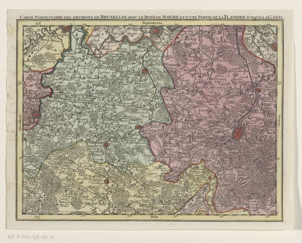
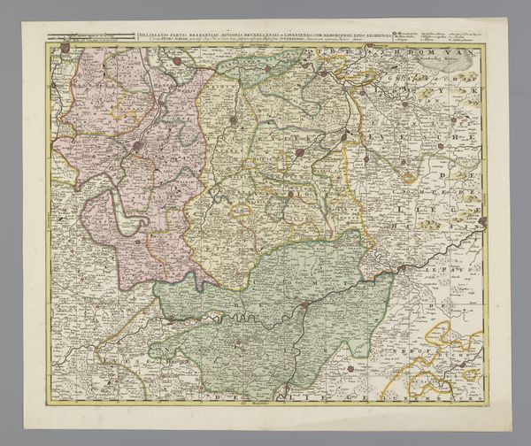
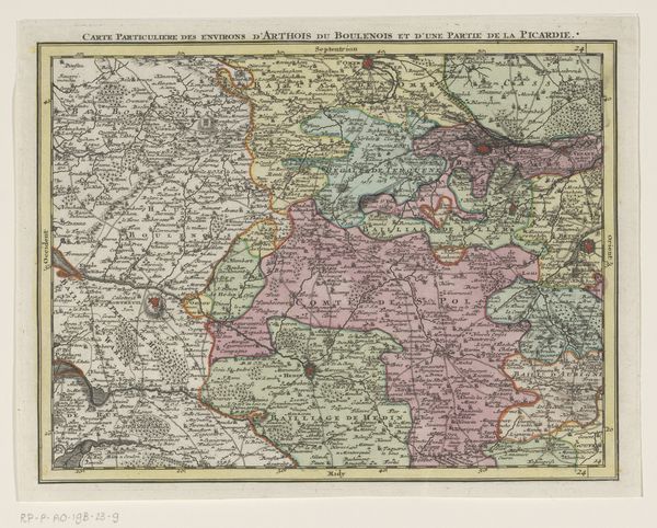
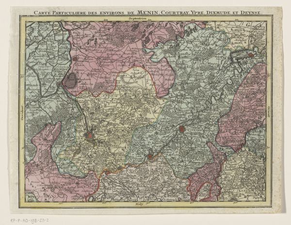
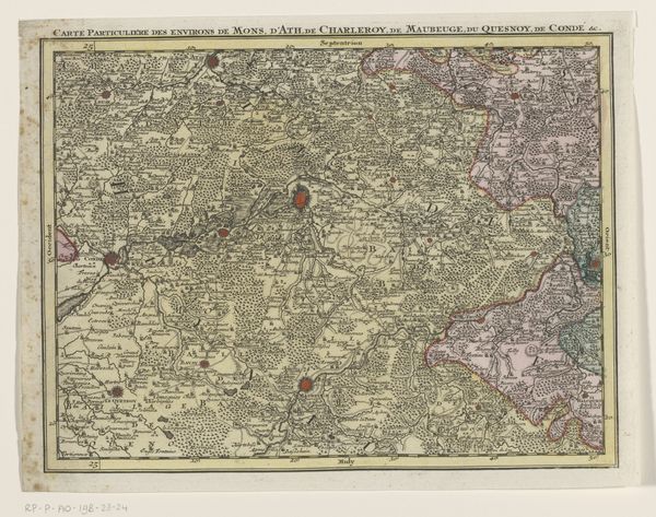
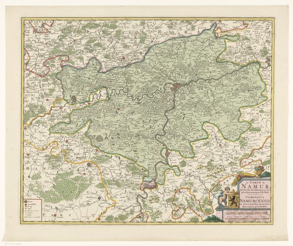
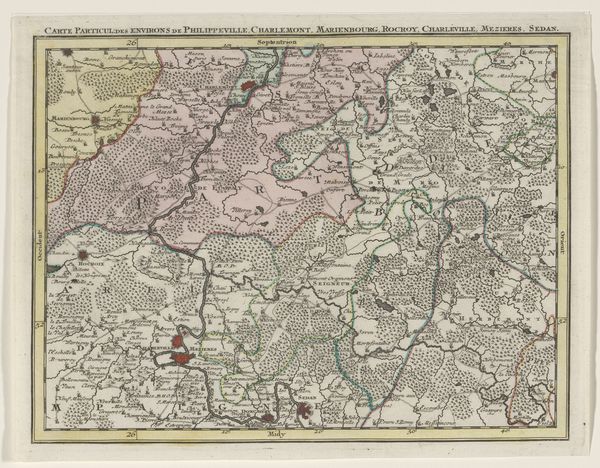
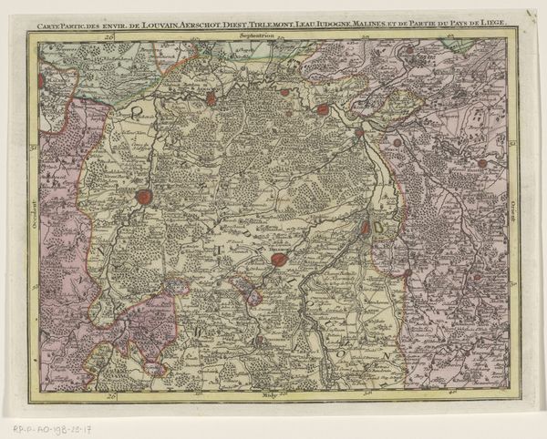
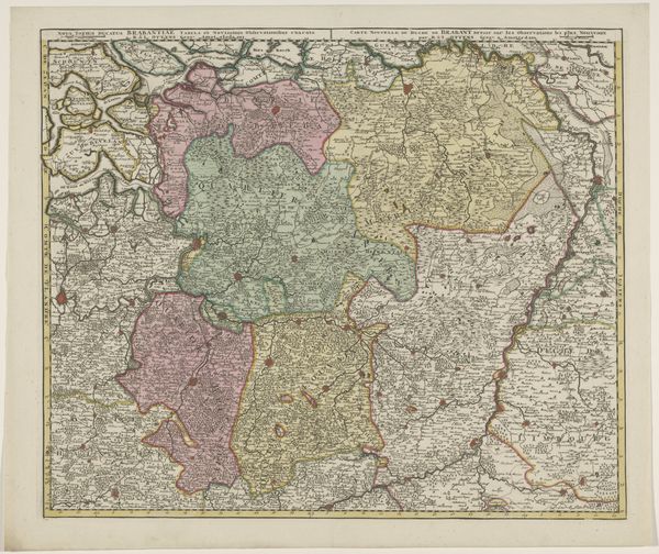
Dimensions: height 204 mm, width 272 mm
Copyright: Rijks Museum: Open Domain
Curator: The lines in this etching remind me of delicate spiderwebs spun over the land. Editor: Well, precisely! Here we have "Deel van een kaart van de Oostenrijkse Nederlanden"—or, a section of a map of the Austrian Netherlands—created sometime between 1737 and 1757 by Tobias Conrad Lotter. It offers such detail! It really does bring to life a place and time. Curator: It’s intriguing how landscape transforms into something almost decorative through the eyes, or rather, the hands, of a cartographer. It feels both functional and deeply imaginative, almost a painting! Editor: Yes, these maps straddle the line between art and science. Looking at it now, one might miss the power dynamics inherent in mapping and claiming space during the rise of European empires. Maps weren't just neutral depictions; they were instruments of power. Curator: Instruments of power… Like a meticulously rendered fantasy. It’s odd to think of all the walking it would take to confirm these landscapes. So much physical labor turned into an abstract representation! Editor: Indeed. I also see it within the larger context of Baroque artistry; everything ornamented and layered, almost an exuberance on the page, to match that moment in history! Curator: Exactly! So alive and striving to define every boundary and little copse of trees. Is it human nature to try and capture it all, contain the world in neat little segments? And what is the cost, now, of that desire to catalog? Editor: Such a dense piece of work. We are prompted to reflect on both the ambition and the artifice embedded in mapping and envisioning our world. I hope people walk away from this seeing the complexity and the implications of how spaces are defined and represented. Curator: Well, if it makes anyone pause and consider the beautiful, impossible task of truly knowing a place, or anything, really, that’s good enough for me.
Comments
No comments
Be the first to comment and join the conversation on the ultimate creative platform.
More like this