print, etching
#
baroque
# print
#
etching
#
old engraving style
#
etching
#
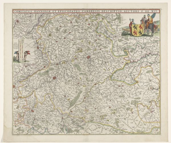
cityscape
Dimensions: height 492 mm, width 563 mm
Copyright: Rijks Museum: Open Domain
This undated map of part of Flanders is an example of early printmaking. It shows us the region as seen through the eyes of its commissioner, in this case, F. de Wit. This detailed map would have begun with a carefully engraved metal plate, a skilled, laborious process. The plate was then inked and pressed onto paper, transferring the image. Finally, watercolor was meticulously applied by hand to delineate borders and highlight key features. The color isn’t just decoration; it signifies ownership and control. This was a valuable object, demonstrating the commissioner's wealth and status. The act of mapping wasn't just about geography; it was about power. The map presents a particular worldview, emphasizing political boundaries and trade routes, reinforcing social hierarchies, and influencing trade and military campaigns. Considering the materials and processes involved in its creation allows us to appreciate the social and cultural context of this seemingly simple map, and to understand the economic and political power relations it presents.
Comments
No comments
Be the first to comment and join the conversation on the ultimate creative platform.
More like this