print, etching, graphite, engraving
#
pen drawing
# print
#
etching
#
landscape
#
graphite
#
engraving
Dimensions: height 459 mm, width 542 mm
Copyright: Rijks Museum: Open Domain
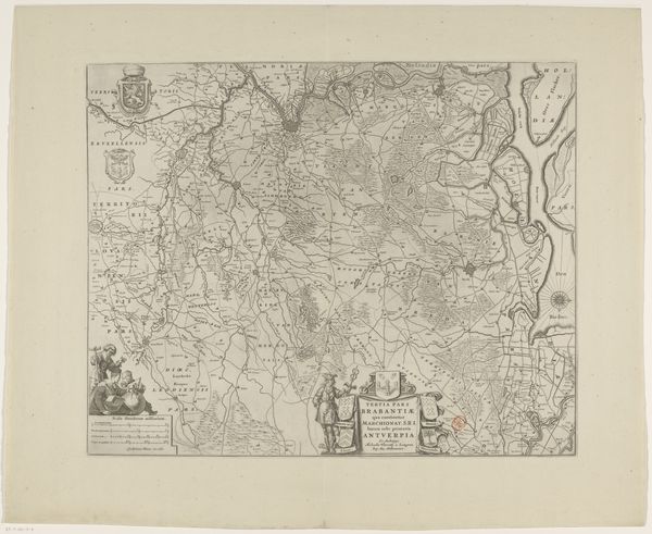
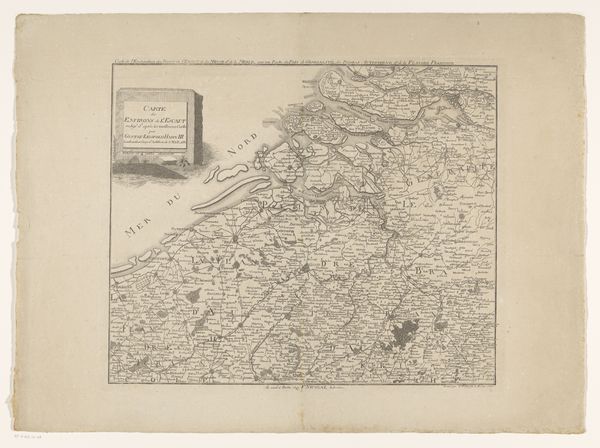
This is an uncredited map of the southern part of the Duchy of Brabant. Brabant was a historical region in the Low Countries, and this map offers a window into its geographical and political landscape. In pre-modern Europe, maps were far from objective tools. The region was a site of shifting alliances and territorial disputes between powerful families, and this map reflects those competing interests. Mapping territory also equaled claiming power. In that sense, the production of maps was also an exercise in nation-building. The inclusion of heraldic symbols, cityscapes, and other decorative elements alongside geographical data served to enhance the prestige and authority of the region and its rulers. The map can be seen as an assertion of identity, both for those who lived within its borders and for those who sought to understand and control it from afar. But it also shapes our imagination, because to draw a boundary is also to exclude. The personal act of drawing a line on a map is therefore always also a political act.
Comments
No comments
Be the first to comment and join the conversation on the ultimate creative platform.
More like this