graphic-art, print, etching, engraving
#
graphic-art
# print
#
etching
#
landscape
#
etching
#
history-painting
#
engraving
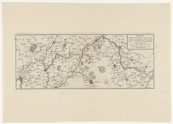
Dimensions: height 272 mm, width 422 mm
Copyright: Rijks Museum: Open Domain
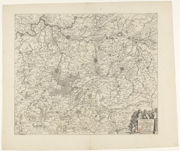
Curator: This print, dating from the turn of the 19th century, is entitled "Kaart van het oorlogsgebied in de Oostenrijkse Nederlanden in 1793-1794"— a map of the war zone in the Austrian Netherlands, now Belgium, during those years. Editor: Immediately, what strikes me is the intense detail rendered through the etching and engraving, the way the fine lines coalesce to map out a turbulent territory. It feels incredibly precise, almost clinical in its depiction of a zone defined by conflict. Curator: The print gives us a fascinating window into the politics of cartography. Beyond a geographical representation, maps such as these are always an assertion of power. The borders drawn, the sites marked - they tell a specific story about who controlled what, and how they saw their own dominion. The Austrian Netherlands was a complex area contested by multiple powers. Editor: I see that, and the almost obsessive detailing gives an aura of authority, lending weight to this perspective. But how are we to consider the ethics of depicting this landscape? Isn't there an implied glorification? Curator: It is an important question. However, understanding the history painting theme within this print requires a deep dive into the military conflicts of that period. Think about the social consequences, too— the implications for the populations living through these power struggles depicted, not as distant, abstracted features, but inhabited spaces disrupted by war. What experiences and identities were marginalized or erased? Editor: That contextual layering reveals how deeply implicated seemingly 'objective' documents can be, a semiotic web really. I’m left questioning the notion of cartography itself. It claims to depict a territory and, therefore, reality. But actually, what’s it depicting is someone's idea, someone’s understanding and claim of reality, with all their specific biases. Curator: Exactly. Even in something as apparently technical as this, questions of power, representation, and historical trauma are embedded, prompting crucial dialogues about conflict and cultural identity. Editor: Seeing past the precise details reveals the emotional context. Curator: For sure. The landscape, in turn, serves as a ground for exploration of war, memory, and the lasting implications.
Comments
No comments
Be the first to comment and join the conversation on the ultimate creative platform.
More like this