drawing, print, ink, engraving
#
drawing
#
baroque
# print
#
landscape
#
ink
#
geometric
#
cityscape
#
history-painting
#
engraving
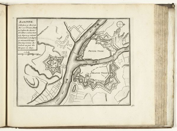
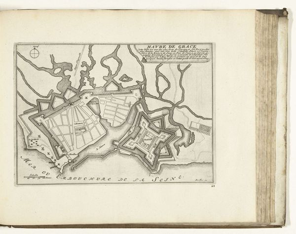
Dimensions: height 228 mm, width 290 mm
Copyright: Rijks Museum: Open Domain
Editor: Here we have "Plattegrond van Bayonne," a print, drawing, and engraving in ink, dating from around 1693-1696, by an anonymous artist. Its clean lines and geometric shapes give it an air of precision and order. What compositional elements stand out to you in this image? Curator: Indeed, the orthogonal structure is immediately apparent. The work deploys geometry to divide the space. Observe how the river acts as a central organizing principle, bisecting the composition while simultaneously serving as a visual link between the Petite Ville and Grande Ville. Note also the bastion forts; these octagonal shapes lend balance, reflecting each other across the river's divide. How do you perceive their function within the work's overall structure? Editor: They seem to anchor the composition, creating points of visual interest that draw the eye. The stark contrast between the lines depicting the fortifications and the more fluid lines representing the natural landscape really defines those regions. Is this interplay intentional, do you think? Curator: Undoubtedly. It signifies a crucial binary—that between the natural and the man-made, underscoring human efforts to exert control over the environment through geometric, regulated forms. Furthermore, reflect on the absence of tonal variation. This suggests a prioritization of line and form over illusionistic depth, redirecting focus toward the two-dimensional plane and the intellectual mapping of space rather than a picturesque view. Do you notice any other tensions present within the picture? Editor: It’s interesting how the relatively loose rendering of the landscape contrasts the very rigid design of the fortress. That really emphasizes the tension between control and freedom. Thanks for pointing that out. Curator: You're welcome. Such visual contrasts emphasize the complexity inherent in even seemingly straightforward representational images.
Comments
No comments
Be the first to comment and join the conversation on the ultimate creative platform.
More like this