drawing, print, paper, ink, engraving
#
drawing
#
baroque
# print
#
pen sketch
#
paper
#
ink
#
geometric
#
cityscape
#
engraving
Dimensions: height 211 mm, width 282 mm
Copyright: Rijks Museum: Open Domain
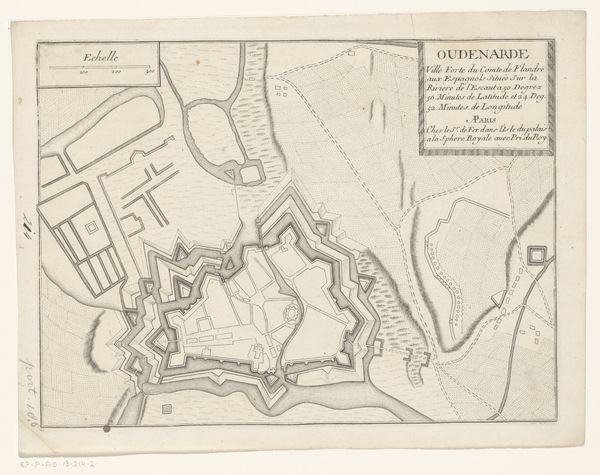
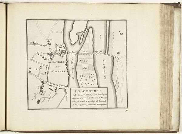
This is an anonymous etching from around 1702, a plattegrond, or plan, of the city of Oudenaarde. At first glance, it’s a simple, unassuming image, but it speaks volumes about early modern Europe. Notice the fortifications: these star-shaped walls weren't just decorative, they were a response to the changing nature of warfare. Oudenaarde, located in present-day Belgium, was a strategically important city and its plan reflects the constant power struggles between European nations at the time. This map wasn't created in a vacuum; it was produced in Paris, indicating the centralized authority of the French state and its interest in controlling the region. As an historian, I’m interested in understanding the social conditions that made this image possible. By looking at historical archives, military records and other maps from this period, we can begin to understand the role that Oudenaarde played in the larger story of European power politics.
Comments
No comments
Be the first to comment and join the conversation on the ultimate creative platform.
More like this