drawing, paper, ink, engraving
drawing
baroque
paper
ink
geometric
cityscape
engraving
Dimensions: height 191 mm, width 251 mm
Copyright: Rijks Museum: Open Domain
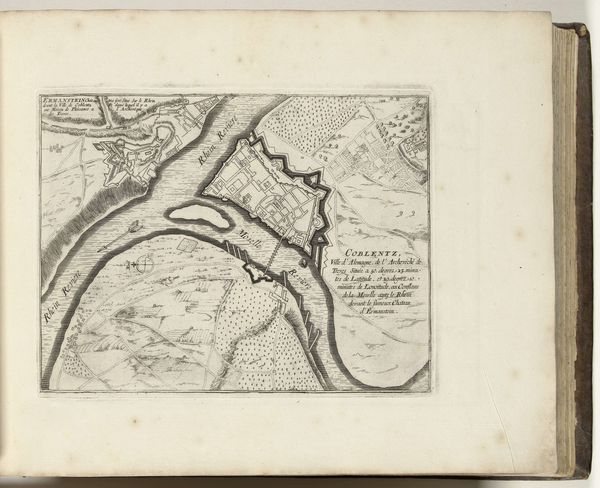
This is an anonymous map of Koblenz, made in 1726. The print presents an aerial view of the city using thin, precise lines to delineate buildings, rivers and fortifications. The composition, tightly framed, invites close inspection of its intricate details. Notice how the lines create a structured vision, almost abstract, where natural and man-made elements are equally codified. The river becomes a dominant form, bisecting the space and around which the city seems strategically organized. The use of lines and symbols functions as a semiotic system, each stroke and shape serving as a signifier within the cartographic language of the time. This map doesn't just represent space; it encodes power, strategy, and knowledge. It's a reminder that even seemingly objective representations are laden with cultural and political meanings.
Comments
No comments
Be the first to comment and join the conversation on the ultimate creative platform.