About this artwork
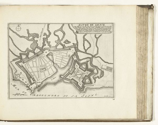
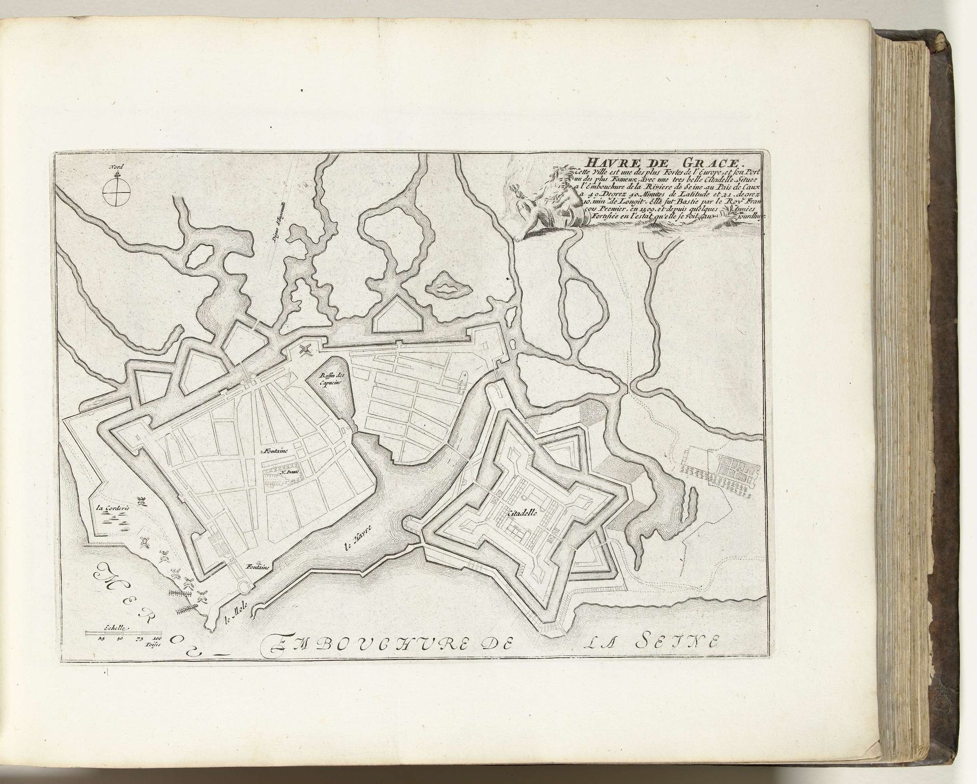
Curator: Look at this remarkable engraving from around 1693-1695, a "Plattegrond van Le Havre" – a map of Le Havre, created anonymously, and held at the Rijksmuseum. The delicate pen work on paper, combined with the printed lines, captures the city and its surroundings with incredible precision. Editor: My initial impression is one of control, almost clinical. The careful hatching and geometrical shapes remind me that maps of cities weren't just about directions but asserting dominion. The fine lines making up each structure evoke a sense of careful production too, each pen stroke represents labour and skill. Curator: Precisely. Le Havre, a major port city in France, was of strategic importance. These city plans, of which there were many made, weren't just documents of geography, but of military and economic power, circulated among elites. The layout showcases the formal planning prevalent during that era, reflective of broader cultural and political systems. Editor: Absolutely, and I wonder who commissioned this particular piece and for what purpose? The precise execution hints at investment. Were these distributed amongst investors perhaps to highlight a booming, modern industrial economy, and, maybe they encouraged further exploitation and control? Curator: It's fascinating to consider. Maps also played a critical role in solidifying national identities, but this seems focused less on the picturesque, or what we today associate with 'art', and more on pragmatic visual representation. It also shows a specific engagement with that academic baroque art style. Editor: Speaking of that aesthetic—what paper and inks would they have used, and how might the production methods affected distribution and access? The labour to engrave these metal plates would have been a big commitment, signaling its importance in the reproduction. What were the socio-economic impacts and labour practices? Curator: A great question that expands beyond simply what is depicted and enters into its materiality, I appreciate you highlighting this point. The historical narrative behind cartography itself deserves further examination, especially when considering how these images were used by particular people to justify actions that served power. Editor: Agreed, analyzing these kinds of materials helps understand broader themes about control and resource distribution. These elements offer a wider insight into the time and intention for its production. Curator: Indeed, and remembering these historical and material components allows a better sense for this map of Le Harve from the 1690s. Editor: And considering all of that reveals how many layers of control these types of depictions represent.
Artwork details
- Medium
- drawing, print, paper, ink, engraving
- Dimensions
- height 200 mm, width 281 mm
- Location
- Rijksmuseum
- Copyright
- Rijks Museum: Open Domain
Tags
Comments
Share your thoughts
About this artwork
Curator: Look at this remarkable engraving from around 1693-1695, a "Plattegrond van Le Havre" – a map of Le Havre, created anonymously, and held at the Rijksmuseum. The delicate pen work on paper, combined with the printed lines, captures the city and its surroundings with incredible precision. Editor: My initial impression is one of control, almost clinical. The careful hatching and geometrical shapes remind me that maps of cities weren't just about directions but asserting dominion. The fine lines making up each structure evoke a sense of careful production too, each pen stroke represents labour and skill. Curator: Precisely. Le Havre, a major port city in France, was of strategic importance. These city plans, of which there were many made, weren't just documents of geography, but of military and economic power, circulated among elites. The layout showcases the formal planning prevalent during that era, reflective of broader cultural and political systems. Editor: Absolutely, and I wonder who commissioned this particular piece and for what purpose? The precise execution hints at investment. Were these distributed amongst investors perhaps to highlight a booming, modern industrial economy, and, maybe they encouraged further exploitation and control? Curator: It's fascinating to consider. Maps also played a critical role in solidifying national identities, but this seems focused less on the picturesque, or what we today associate with 'art', and more on pragmatic visual representation. It also shows a specific engagement with that academic baroque art style. Editor: Speaking of that aesthetic—what paper and inks would they have used, and how might the production methods affected distribution and access? The labour to engrave these metal plates would have been a big commitment, signaling its importance in the reproduction. What were the socio-economic impacts and labour practices? Curator: A great question that expands beyond simply what is depicted and enters into its materiality, I appreciate you highlighting this point. The historical narrative behind cartography itself deserves further examination, especially when considering how these images were used by particular people to justify actions that served power. Editor: Agreed, analyzing these kinds of materials helps understand broader themes about control and resource distribution. These elements offer a wider insight into the time and intention for its production. Curator: Indeed, and remembering these historical and material components allows a better sense for this map of Le Harve from the 1690s. Editor: And considering all of that reveals how many layers of control these types of depictions represent.
Comments
Share your thoughts