drawing, print, ink, engraving
#
drawing
# print
#
pen sketch
#
ink
#
geometric
#
cityscape
#
engraving
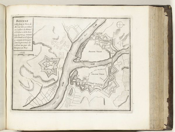
Dimensions: height 220 mm, width 296 mm
Copyright: Rijks Museum: Open Domain
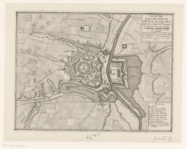
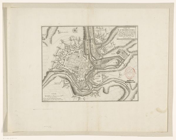
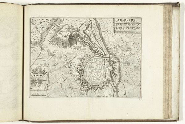
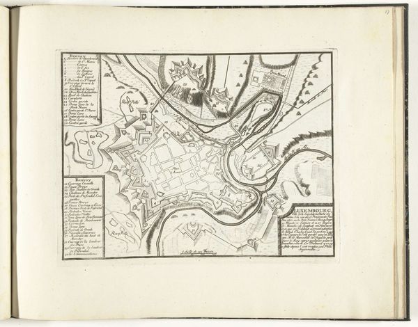
Curator: Here at the Rijksmuseum, we have a fascinating depiction of Bayonne, a city in the Basque Country, rendered in 1726 by an anonymous artist. It is created as a print in ink and shows a geometric plan of the cityscape. Editor: The visual harmony of it strikes me first— the delicate balance of the geometric forms against the open space. There’s a stark beauty in the lines, a rigidness that seems almost mathematical. Curator: Exactly! Notice the strategic positioning of the fortifications; key in that historical period to establish power but also control society. How does that layout define life in Bayonne at that time? Editor: Semiotically, the geometric shapes immediately communicate order and control, an almost architectural attempt to confine the organic flow of urban life. Look at those fortifications—perfect, imposing shapes, deliberately artificial and monumental. Curator: Right, these walls tell a story, it communicates both protection and control in the province. The city plan becomes an explicit power statement; it projects an image to neighbors but also asserts the control of Bayonne and France over the Basques people. Editor: But in aesthetic terms, consider how the artist's careful modulation of line weight—from the bold outlines to the fainter, interior details—creates a nuanced, visually appealing map of the region. It transforms information into art. Curator: I would say it transforms ideology into spatial form. This work tells more than just geography but about statecraft. Every angle on this plattegrond becomes part of the political argument of space, place, and state building. Editor: Perhaps the most telling quality of the print comes from how the artist chose to represent geographic space using these hard-edged forms and structured visual hierarchy. That choice underscores what this city symbolizes culturally, historically, politically. Curator: We’ve managed to get a glimpse into history through geography and urban planning— fascinating. Editor: Agreed; the convergence of art, design, and power presented in such stark, elegant terms allows an engagement for more perspectives.
Comments
No comments
Be the first to comment and join the conversation on the ultimate creative platform.
More like this