drawing, print, paper, ink, engraving
drawing
baroque
pen sketch
paper
ink
cityscape
history-painting
engraving
realism
Dimensions: height 199 mm, width 281 mm
Copyright: Rijks Museum: Open Domain
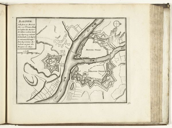
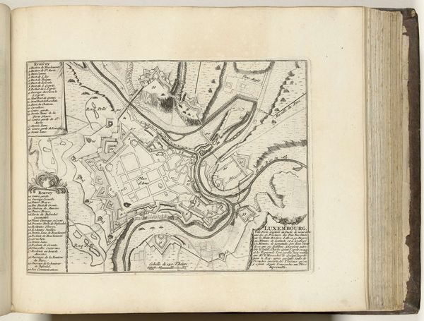
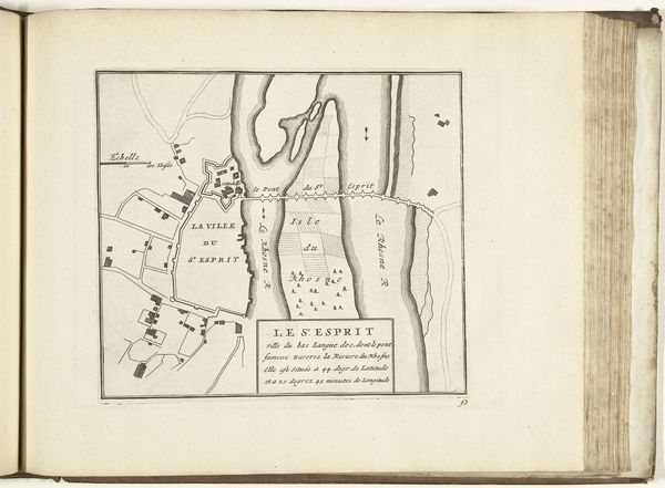
This is a 1726 anonymous etching at the Rijksmuseum, titled "Plattegrond van Le Havre." Notice the prominent star fortresses—these shapes are more than mere fortifications. The star fort, with its angular bastions, symbolizes a shift in military strategy, but also something deeper. This geometrical form, designed to deflect cannon fire, echoes a primal human desire for protection, yet it also represents dominance and control. Consider how similar geometric patterns appear in religious architecture across the world, from mandalas to labyrinths. These patterns resonate with the unconscious mind, evoking feelings of security and power. Yet, the star fortress, with its sharp angles and imposing presence, also hints at the anxieties and conflicts of the time. The image engages our psyche, reminding us that these historical emblems are not merely relics of the past but symbols of enduring human impulses.
Comments
No comments
Be the first to comment and join the conversation on the ultimate creative platform.