1695 - 1697
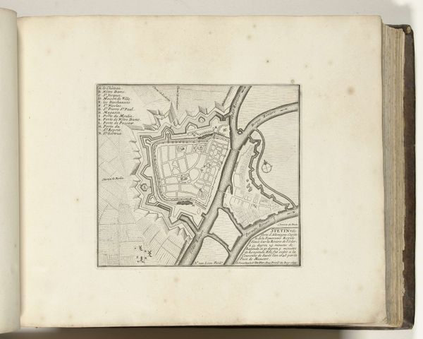
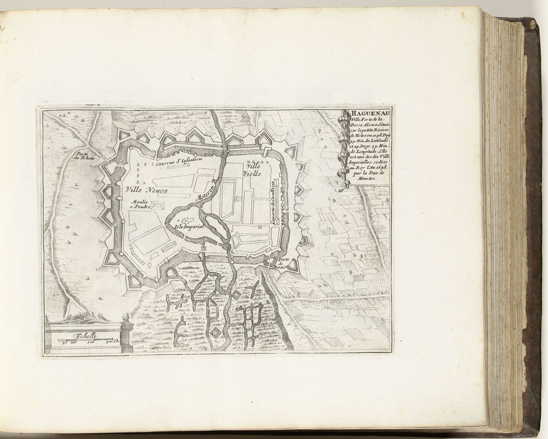
Plattegrond van Haguenau, ca. 1695
Anonymous
@anonymousLocation
RijksmuseumListen to curator's interpretation
Curatorial notes
This is an anonymous map of Haguenau, made around 1695. The detailed plan offers a glimpse into the 17th century, a period marked by territorial disputes and military strategy. Notice how the city is divided into 'Ville Neuve' and 'Ville Vielle', new and old town, reflecting an era of urban expansion shaped by both progress and conflict. The fortifications speak to the constant threat of invasion and the need to protect resources and inhabitants. The anonymous nature of the artist speaks to the fact that map making at this time was a technical, rather than artistic endeavor. Consider the emotional landscape of the people living within these walls. This was a society structured by class, gender and access to resources; a lived experience of constant negotiation, and of existing within defined boundaries. This map is not just a geographical document; it's a portrayal of power, identity, and the human experience during a transformative period in European history.