#
aged paper
#
toned paper
#
old engraving style
#
personal sketchbook
#
pen-ink sketch
#
pen and pencil
#
pen work
#
sketchbook drawing
#
storyboard and sketchbook work
#
sketchbook art
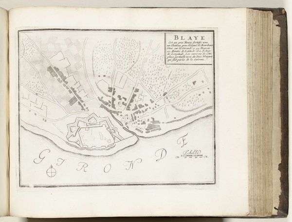
Dimensions: height 223 mm, width 295 mm
Copyright: Rijks Museum: Open Domain
This is an anonymous map of Blaye, made in 1726, with an unknown medium. Situated in the early 18th century, it’s a period marked by burgeoning colonialism and complex power dynamics across Europe. What does it mean to map a place? Maps aren’t neutral; they're imbued with the power to define territories and assert control. Consider this map in the context of its time - likely commissioned by those in power to solidify their understanding and dominion over the region. The rendering of Blaye, with its emphasis on strategic positioning along the Gironde estuary, speaks volumes about military and economic interests. Who lived here? How did the act of mapping impact their lives and sense of belonging? Ultimately, this map serves as a reminder that every representation of space is also a representation of power, shaping not just our understanding of geography, but also the lived experiences of those within it.
Comments
No comments
Be the first to comment and join the conversation on the ultimate creative platform.
More like this