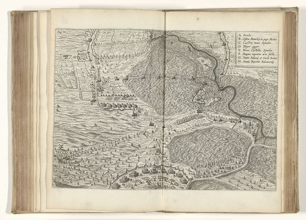
Kaart met het kampement van de keizerlijke troepen bij Heilbronn, 1695 1726
0:00
0:00
anonymous
Rijksmuseum
drawing, ink, engraving
#
drawing
#
aged paper
#
toned paper
#
baroque
#
pen sketch
#
old engraving style
#
landscape
#
personal sketchbook
#
ink
#
ink drawing experimentation
#
pen-ink sketch
#
pen work
#
sketchbook drawing
#
history-painting
#
sketchbook art
#
engraving
Dimensions: height 222 mm, width 280 mm
Copyright: Rijks Museum: Open Domain
This is an anonymous map from 1695, titled "Kaart met het kampement van de keizerlijke troepen bij Heilbronn", which translates to "Map of the camp of the imperial troops near Heilbronn." The map offers a stark representation of military strategy during a time of intense political and territorial conflict in Europe. Though anonymous, the mapmaker was likely embedded within the military or commissioned to document troop movements, thus occupying a position of power and influence. The imagery prioritizes a bird’s eye view of fortifications over the human cost of war. Consider how the clean, precise lines contrast with the chaotic reality of warfare, where individuals of different classes and backgrounds were thrust into violence, often without agency. Maps like these served as tools for planning and control but also shaped perceptions of land and power. They reinforce societal hierarchies and control, reducing people and places to strategic assets. The emotional impact lies in recognizing how such documents, seemingly objective, deeply influenced the lives and identities of countless individuals involved in these conflicts.
Comments
No comments
Be the first to comment and join the conversation on the ultimate creative platform.
More like this