drawing, paper, ink
#
drawing
#
baroque
#
paper
#
ink
#
cityscape
#
history-painting
Dimensions: height 226 mm, width 286 mm
Copyright: Rijks Museum: Open Domain
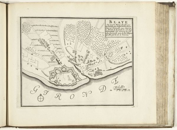
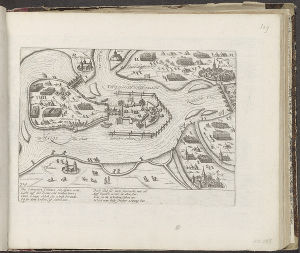
Editor: Here we have an anonymous drawing titled "Plattegrond van Blaye," created around 1693-1696 using ink on paper. It's a meticulously rendered cityscape that feels almost architectural in its precision. What immediately strikes me is the intricate geometrical nature of the Blaye Citadel. What do you see in this piece? Curator: Formally, I am captivated by the stark contrast between the geometric rigidity of the fortress and the more organic forms representing the town and landscape. Note how the draftsman employed a limited tonal range of ink to achieve depth and differentiate textures, isn't it fascinating? Editor: It is! The shading is quite subtle, yet it effectively conveys a sense of three-dimensionality despite the flat perspective typical of maps. Could you say more about the composition and its effect? Curator: The composition leads the eye from the highly structured fortress, anchoring the image, to the freely drawn environment surrounding it. The rigid lines of the fortress are deliberately juxtaposed with the flowing lines delineating the river, creating a visual tension, a semiotic relationship indicative of man versus nature. The question of authorship becomes almost secondary in the context of pure structural study, wouldn’t you agree? Editor: That’s a great point! Focusing on these dichotomies helps one notice the overall balance the artist strikes between the rigid geometry and organic forms. I now see the drawing as more dynamic and balanced than I initially perceived. Curator: Precisely. It allows for us to move past any specific narrative consideration. Focusing solely on the pure forms, lines, and balance—these can unlock the enduring quality of the piece.
Comments
No comments
Be the first to comment and join the conversation on the ultimate creative platform.
More like this