About this artwork
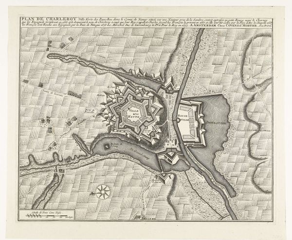
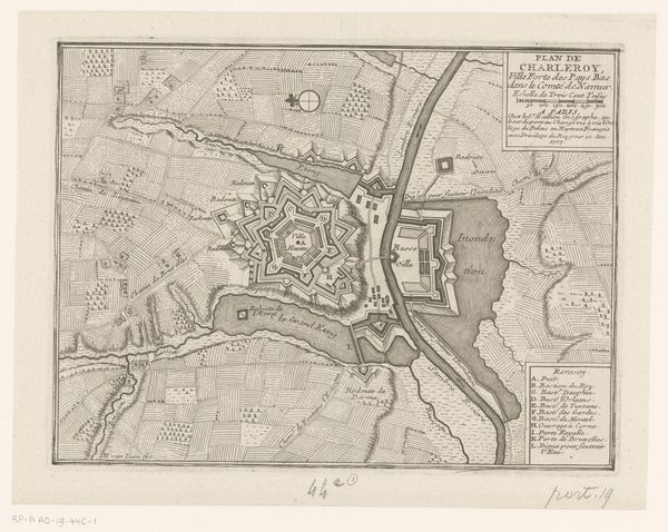
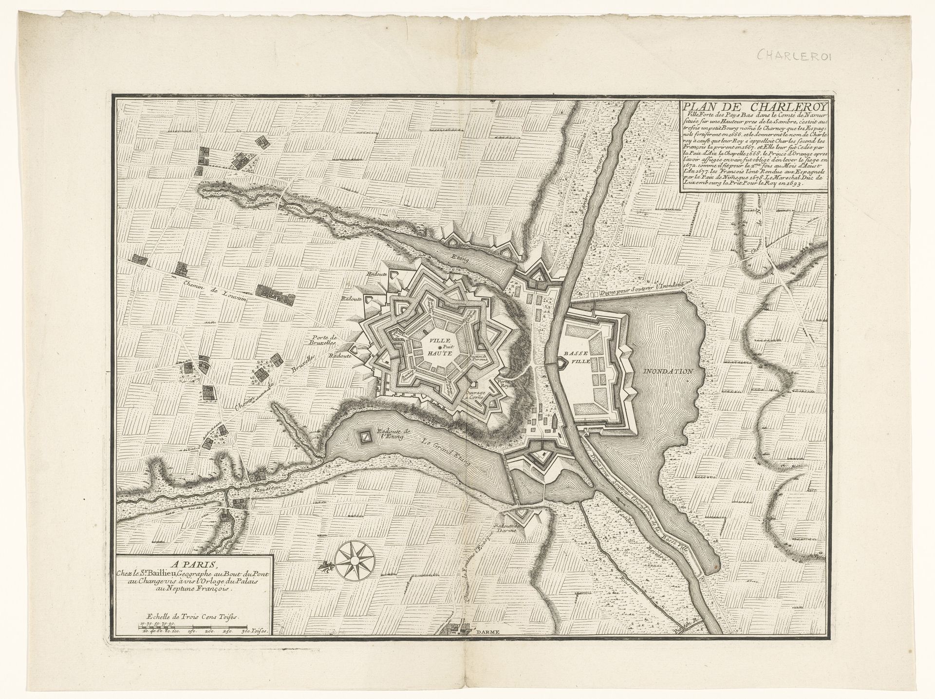
Editor: This is an engraving titled "Vestingplattegrond van Charleroi", which translates to "Fortified Map of Charleroi," created sometime between 1693 and 1744. The map is an intriguing birds-eye view; almost sterile at first glance because it’s absent of people. What jumps out to you? Curator: Oh, sterility is the *last* thing that comes to mind. I see it vibrating with tense intention. Maps like this are as much about projecting power as documenting place. They embody control—a silent boast. Note how the fort is meticulously designed. Geometric shapes imposing order upon the landscape. A show of Baroque bravado! Does it feel a bit…oppressive? Editor: I see what you mean. There's a lack of…organic feel. Were maps commonly made like this at the time? Curator: Absolutely! The 17th and 18th centuries were booming for cartography. Especially military cartography. Cities became strategic assets. Think about Louis XIV's France - vaunting authority by way of cartographic displays of architectural might and control over landscape. Did the exercise in illustrating authority render that desired state real? Or perhaps was reality being sold via carefully illustrated hope? Editor: It’s so interesting how something as seemingly objective as a map can be such a powerful cultural artifact. Almost a form of propaganda, when you consider it. Curator: Exactly! It is no different than any photograph one may take and edit now to elicit a specific mood. It changes your sense of space, history, everything really. A beautiful, yet terrifying control of how you perceive the world. Editor: I’ll definitely look at maps differently from now on! Thank you.
Artwork details
- Medium
- drawing, print, ink, engraving
- Dimensions
- height 381 mm, width 502 mm
- Copyright
- Rijks Museum: Open Domain
Tags
Comments
Share your thoughts
About this artwork
Editor: This is an engraving titled "Vestingplattegrond van Charleroi", which translates to "Fortified Map of Charleroi," created sometime between 1693 and 1744. The map is an intriguing birds-eye view; almost sterile at first glance because it’s absent of people. What jumps out to you? Curator: Oh, sterility is the *last* thing that comes to mind. I see it vibrating with tense intention. Maps like this are as much about projecting power as documenting place. They embody control—a silent boast. Note how the fort is meticulously designed. Geometric shapes imposing order upon the landscape. A show of Baroque bravado! Does it feel a bit…oppressive? Editor: I see what you mean. There's a lack of…organic feel. Were maps commonly made like this at the time? Curator: Absolutely! The 17th and 18th centuries were booming for cartography. Especially military cartography. Cities became strategic assets. Think about Louis XIV's France - vaunting authority by way of cartographic displays of architectural might and control over landscape. Did the exercise in illustrating authority render that desired state real? Or perhaps was reality being sold via carefully illustrated hope? Editor: It’s so interesting how something as seemingly objective as a map can be such a powerful cultural artifact. Almost a form of propaganda, when you consider it. Curator: Exactly! It is no different than any photograph one may take and edit now to elicit a specific mood. It changes your sense of space, history, everything really. A beautiful, yet terrifying control of how you perceive the world. Editor: I’ll definitely look at maps differently from now on! Thank you.
Comments
Share your thoughts