print, engraving
# print
#
landscape
#
history-painting
#
decorative-art
#
engraving
Dimensions: height 461 mm, width 559 mm
Copyright: Rijks Museum: Open Domain
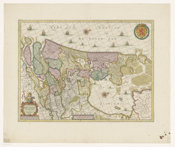
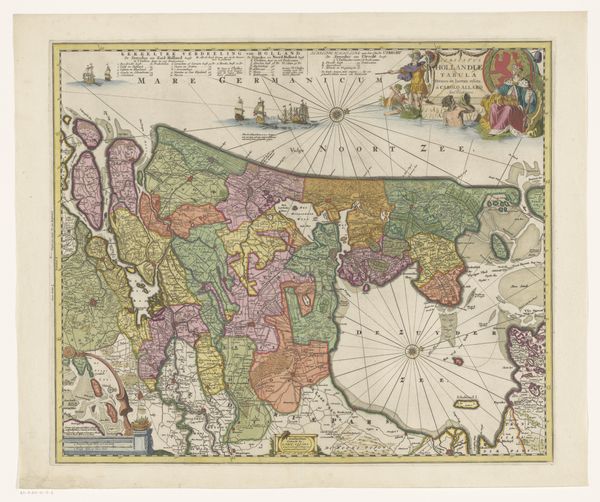
This is an anonymous map of the County of Holland. It’s made using ink and paint, and is printed on paper. Looking closely, notice the composition. The irregular shape of Holland fills most of the frame, surrounded by the North Sea and Zuider Zee. A network of lines marks boundaries and waterways. These lines create a visual structure that defines the space, while patches of subdued reds, greens, and yellows differentiate regions. Ships dot the seas, rendered with detail that contrasts with the more abstract land divisions. Maps are tools of power, delineating territories and asserting control. However, the map also presents a semiotic system. Lines and colors function as signs, representing real-world features through a code understood by its users. This map invites us to consider how space is not just geographical but also a construct, shaped by those who map it. Consider the interplay between representation and reality. As you move on, think about how maps, like all forms of art, do more than just show us the world.
Comments
No comments
Be the first to comment and join the conversation on the ultimate creative platform.
More like this