graphic-art, print, etching
#
graphic-art
#
baroque
# print
#
etching
#
landscape
#
etching
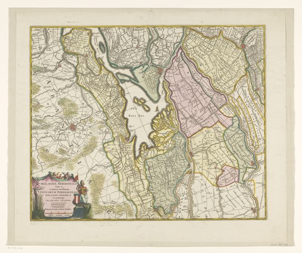
Dimensions: height 463 mm, width 563 mm
Copyright: Rijks Museum: Open Domain
This is an anonymous map of Zuid-Holland. Its precise date is uncertain, but its style tells us a lot about how the Dutch Republic understood itself. The map shows sophisticated skills in surveying and printing. But it’s more than a practical tool. Maps such as these offered early modern Europeans a new way to visualize their place in the world. Consider how this one divides the landscape into neat parcels. The emphasis on territory reflects the political and economic concerns of the Republic's ruling class. The decorative elements such as coats of arms, and allegorical figures, assert the province’s identity. It connects Holland to a glorious past. To properly understand this map, we might consult archives, books, and other images. These could give us a deeper sense of the social and institutional forces that shaped its making. Maps offer us more than geographical data; they are cultural artifacts that tell stories about power, knowledge, and identity.
Comments
No comments
Be the first to comment and join the conversation on the ultimate creative platform.
More like this