print, etching, engraving
#
baroque
#
pen drawing
# print
#
etching
#
landscape
#
linocut print
#
pen and pencil
#
line
#
pen work
#
engraving
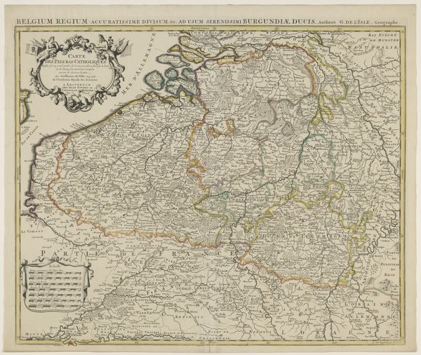
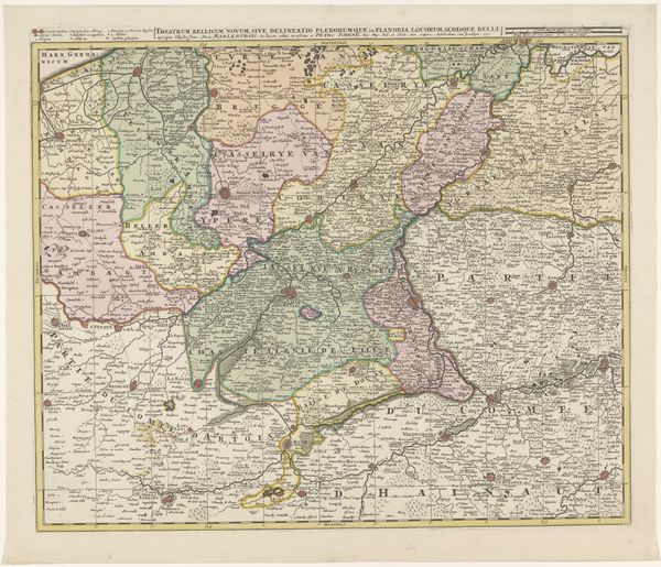
Dimensions: height 204 mm, width 271 mm
Copyright: Rijks Museum: Open Domain
Tobias Conrad Lotter created this segment of a map of the Austrian Netherlands sometime before 1777. The map is laid out in a matrix of shapes and lines. It presents a world ordered and structured through the application of geographical reason. Note the composition. Lotter’s strategic deployment of spatial arrangements and graphic symbols doesn't just represent geographical data; it actively constructs a distinct viewpoint of the territory. Colors demarcate distinct political or geographical zones, and line work highlights borders and routes, crafting a narrative about power, ownership, and movement. This map, therefore, moves beyond simple cartography. It becomes a discourse—shaping understandings of space, influencing perceptions, and reinforcing specific cultural and political viewpoints. Observe how the formal elements create an interplay between objective representation and constructed meaning. It's in this interplay that Lotter's map communicates its complex message.
Comments
No comments
Be the first to comment and join the conversation on the ultimate creative platform.
More like this