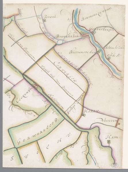
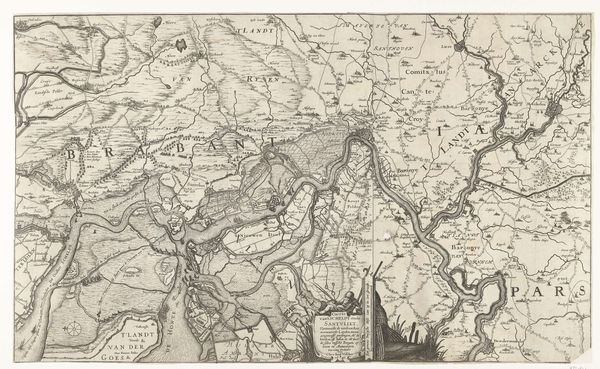
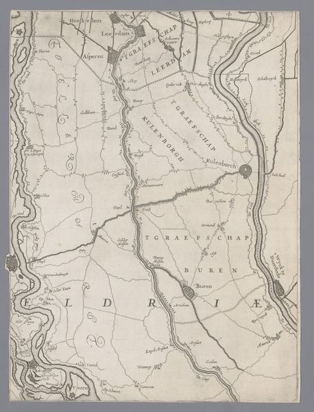
Deel van een kaart van het Hoogheemraadschap van Rijnland, met Loenen en omgeving 1615
0:00
0:00
florisbalthasarszvanberckenrode
Rijksmuseum
drawing, etching, paper, ink
#
landscape illustration sketch
#
drawing
#
map drawing
#
dutch-golden-age
#
etching
#
landscape
#
etching
#
paper
#
ink
#
pen work
Dimensions: height 374 mm, width 289 mm
Copyright: Rijks Museum: Open Domain
This is a section of a map of Rijnland with Loenen and surroundings, created by Floris Balthasarsz van Berckenrode. The map presents a segmented view of the landscape. Notice the interplay of colours, with the pale blues of the waterways contrasting against the muted greens, pinks and yellows of the land divisions. These blocks of colour create a patchwork effect, delineating properties and territories. The meandering river acts as a spine, structuring the composition, and it also serves as a signifier of both division and connection. This design presents a world ordered through geometric and chromatic arrangement. Land and water are organized into a system of spatial logic. The artist uses the map as a framework to reflect a world where nature is mediated through human understanding and governance. Observe how the formal elements of colour and line work together to represent socio-political organization. The map therefore becomes a form of spatial semiotics. It signifies not just geographical space, but also the structures of power, ownership, and the human imposition of order onto the landscape.
Comments
No comments
Be the first to comment and join the conversation on the ultimate creative platform.
More like this