drawing, print, etching, paper, ink
#
drawing
# print
#
etching
#
landscape
#
etching
#
paper
#
ink
#
geometric
#
orientalism
#
academic-art
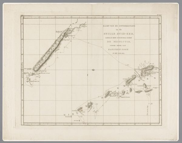
Dimensions: height 249 mm, width 301 mm
Copyright: Rijks Museum: Open Domain
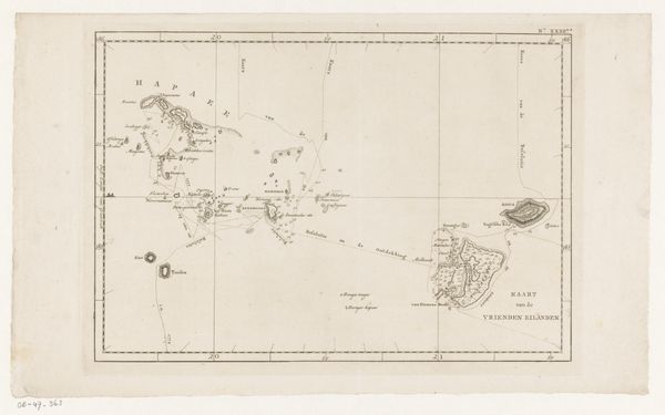
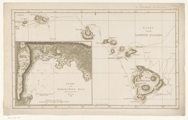
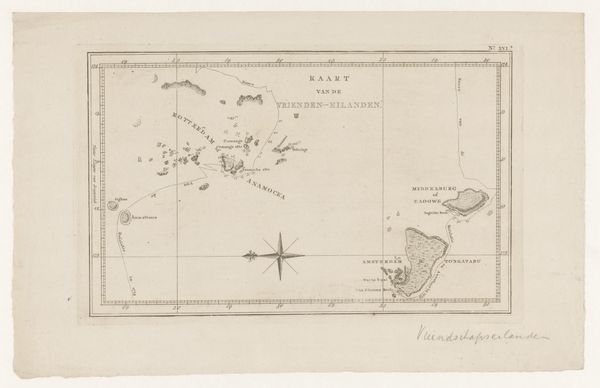
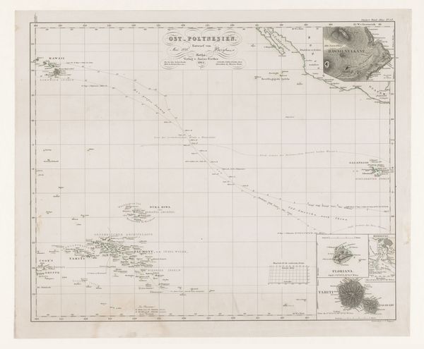
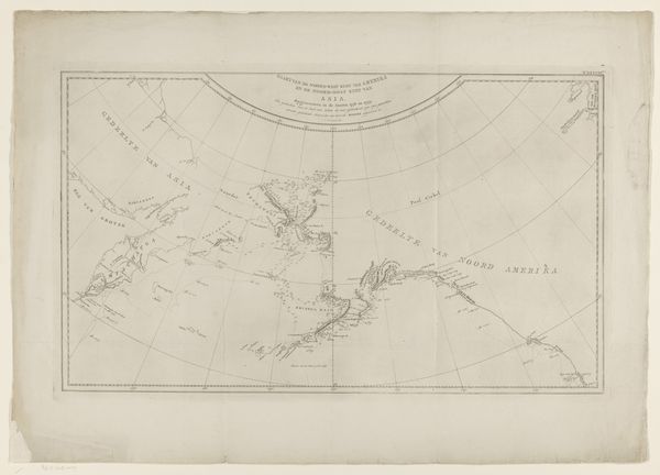
Editor: This is an etching from 1801, "Kaart van de Kerguelen in de Indische Oceaan," by an anonymous artist. It depicts Kerguelen Island. It feels like a very precise document. How do you interpret this work beyond its geographical function? Curator: It’s fascinating to consider this map as more than just a neutral document. The act of mapping itself is deeply embedded in power dynamics. Who gets to define and represent a space? What perspectives are centered, and whose are erased? Editor: That’s interesting! I hadn’t thought about maps in that way before. Curator: Consider that the impulse to map, especially in this era, often came hand-in-hand with colonial ambitions. Understanding the terrain was crucial for resource extraction and control. Look at the specific language used and whose names are attached to geographical features. What does that tell you? Editor: I see. The Dutch title, for one, and place names could point to the colonial influence during that period in that region. It makes the act of representation feel more loaded now. Curator: Exactly. Maps like this, seemingly objective, are always mediated by the social and political contexts of their creation. Exploring those layers reveals so much more than just geographic data. How does that perspective change your initial impression? Editor: It shifts it entirely. What seemed like simple information is actually a complex historical artifact, full of embedded meaning! Curator: Precisely. And it reminds us to question whose perspective we're seeing the world from. Editor: Definitely something to keep in mind for future research! Thanks for illuminating that.
Comments
No comments
Be the first to comment and join the conversation on the ultimate creative platform.
More like this