drawing, print, ink, engraving
#
drawing
#
baroque
# print
#
perspective
#
ink
#
geometric
#
cityscape
#
history-painting
#
academic-art
#
engraving
Dimensions: height 218 mm, width 289 mm
Copyright: Rijks Museum: Open Domain
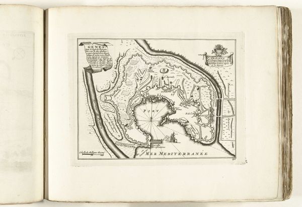
This is an anonymous map of Saint-Malo, made around 1693 to 1695. It’s an engraving, meaning the image was incised into a metal plate, probably copper. Engraving, a printmaking technique, allowed for the detailed and precise rendering of architectural layouts and geographical features seen here. The fine lines and hatched areas create a sense of depth, delineating buildings, fortifications, and the surrounding landscape. But it was also laborious, requiring skilled craftsmanship and time-consuming work. Consider the social context: maps like these were crucial for military strategy, urban planning, and trade, reflecting the power dynamics of the time. The act of mapping itself was a form of control, transforming physical space into a legible, manageable format, for both the elite and the military. The social status of Saint-Malo is communicated through the depiction of military figures in the lower right corner, suggesting a celebration of the city's maritime power. So next time you see a map, consider the labor and power structures embedded within its lines, blurring the lines between art, craft, and social history.
Comments
No comments
Be the first to comment and join the conversation on the ultimate creative platform.
More like this