mixed-media, print
mixed-media
baroque
dutch-golden-age
landscape
cityscape
Dimensions: height 382 mm, width 533 mm
Copyright: Rijks Museum: Open Domain
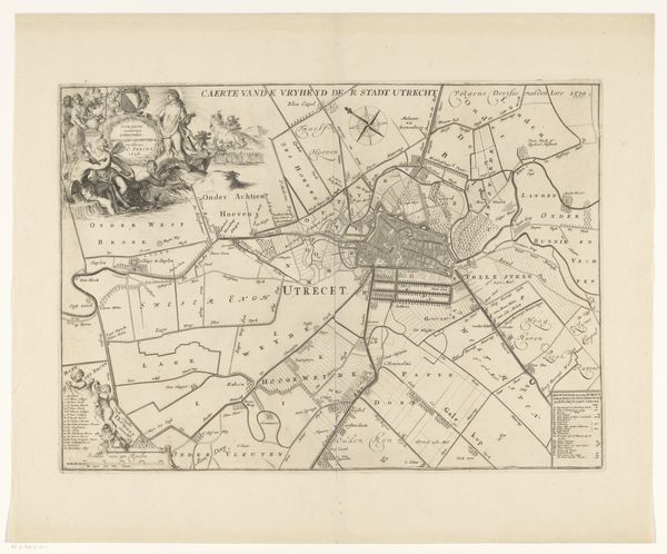
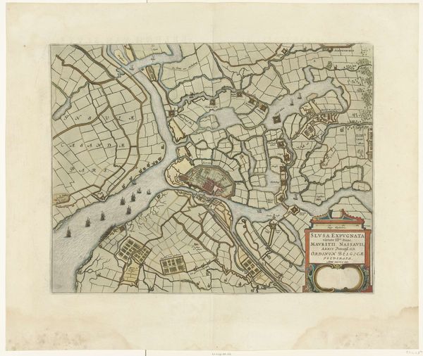
This undated map of Utrecht, by an anonymous artist, offers a fascinating composition of space and power. At first glance, one is struck by the intricate delineation of urban and rural landscapes. The city, rendered in a dense web of lines and blocks of colour, contrasts sharply with the open, gridded fields that surround it. The cartographer's hand transforms the physical world into a semiotic system. Each line, shape, and colour functions as a sign, encoding information about territory, ownership, and control. Note the deliberate contrast between the organic sprawl of the countryside, and the geometric precision of the city. This not only reflects different modes of life but also subtly reinforces the idea of urban civilization as a triumph of order over nature. Consider how the map functions as a tool of governance, demarcating boundaries and asserting jurisdiction. Its aesthetic qualities are inseparable from its political function. While it presents itself as a neutral representation of space, it actively constructs a particular vision of power relations, inviting us to consider how maps have always been instruments of ideology.
Comments
No comments
Be the first to comment and join the conversation on the ultimate creative platform.