About this artwork
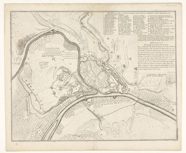
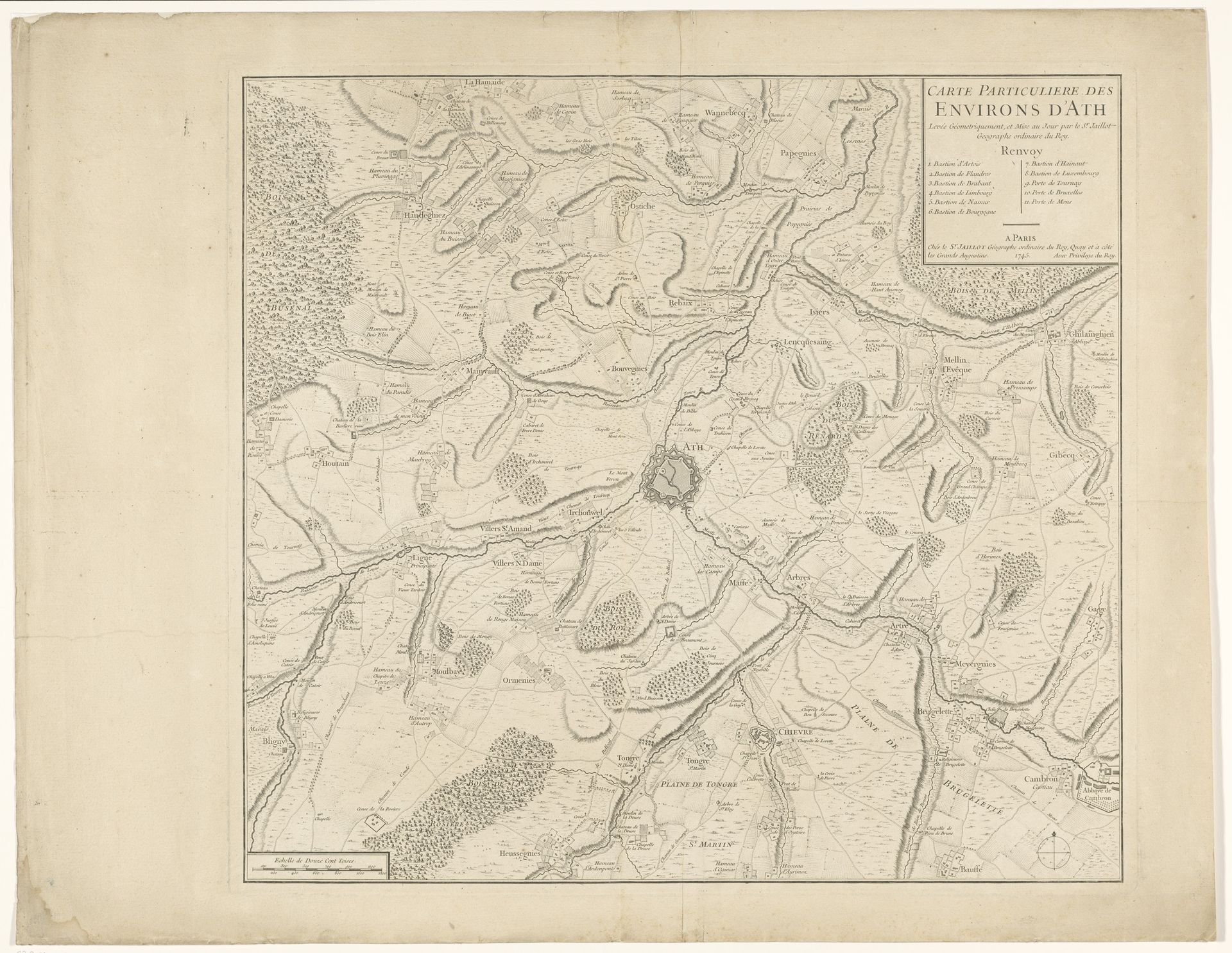
This undated map, "Plattegrond van Aat en zijn omgeving", was anonymously crafted, presenting us with an intricate view of the town of Ath and its surroundings. The map is rendered with delicate lines that trace the curves of rivers, roads, and the boundaries of fields. The composition strikes a balance between the organic forms of the landscape and the geometric precision required for cartography. The lines create a network of signs. They signify not just geographical features but also the structures of power and ownership inherent in mapping. The neutral palette reduces the map to its essential structure, highlighting the artificiality of imposed boundaries and classifications. The act of mapping itself can be seen as a form of control and understanding. Yet, the subtle variations and imperfections in the linework hint at the limits of such control. The map serves as a cultural artifact that reflects a particular way of seeing and ordering the world, inviting us to consider the relationship between representation and reality.
Artwork details
- Medium
- print, engraving
- Dimensions
- height 507 mm, width 558 mm
- Copyright
- Rijks Museum: Open Domain
Tags
Comments
Share your thoughts
About this artwork
This undated map, "Plattegrond van Aat en zijn omgeving", was anonymously crafted, presenting us with an intricate view of the town of Ath and its surroundings. The map is rendered with delicate lines that trace the curves of rivers, roads, and the boundaries of fields. The composition strikes a balance between the organic forms of the landscape and the geometric precision required for cartography. The lines create a network of signs. They signify not just geographical features but also the structures of power and ownership inherent in mapping. The neutral palette reduces the map to its essential structure, highlighting the artificiality of imposed boundaries and classifications. The act of mapping itself can be seen as a form of control and understanding. Yet, the subtle variations and imperfections in the linework hint at the limits of such control. The map serves as a cultural artifact that reflects a particular way of seeing and ordering the world, inviting us to consider the relationship between representation and reality.
Comments
Share your thoughts