drawing, print, ink, engraving
#
drawing
#
dutch-golden-age
# print
#
old engraving style
#
ink
#
engraving
Dimensions: height 239 mm, width 290 mm
Copyright: Rijks Museum: Open Domain
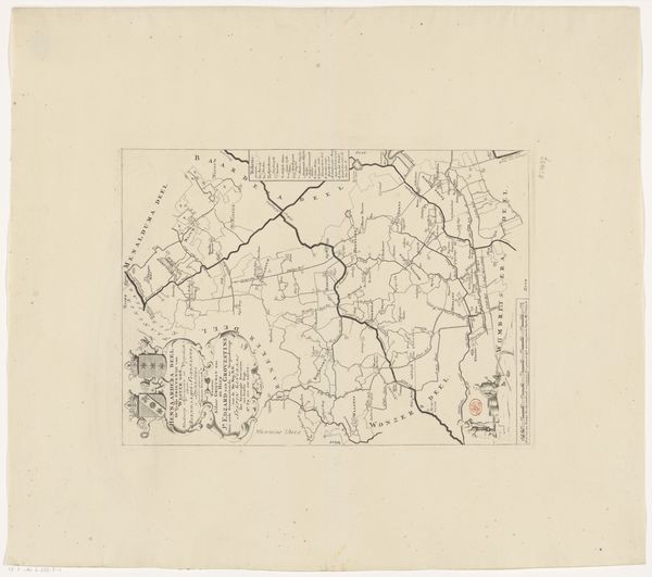
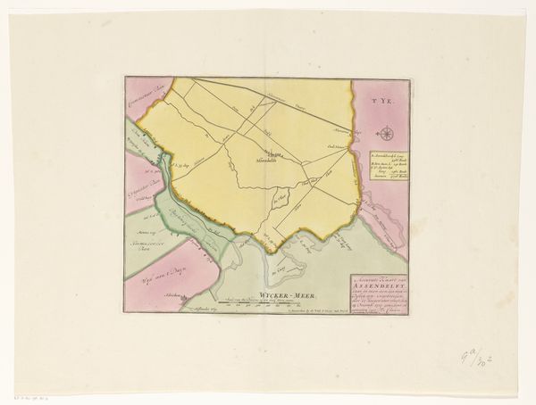
Editor: We’re looking at an engraved map from 1718, titled "Kaart van Assendelft met dijkdoorbraken, 1717," which translates to “Map of Assendelft with breached dikes.” It’s a detailed rendering in ink, and my initial thought is how clearly it demarcates space, almost like a stark diagram. What do you see when you look at this piece? Curator: Its composition reveals a carefully constructed hierarchy. Observe how the lines vary in weight, some boldly defining geographical boundaries, others delicately tracing waterways. This visual structure isn't merely representational; it's a deliberate arrangement intended to convey information and potentially, a specific viewpoint on the landscape and its vulnerability. Note the sharp delineation, which offers a precise and objective feel, seemingly free from embellishment. What structural elements contribute to this effect of detached precision? Editor: I guess the stark contrast between the lines and empty spaces. The shapes almost seem like abstract forms independent from their function as a map. Is it fair to say that this is almost an early form of information art? Curator: I would argue it shares visual language with abstract expressionism in the sense that each area or form contributes to an overall composition. Its intention is rooted in function rather than purely aesthetic exploration, though. Consider how the very materiality of the engraving—the incised lines on the plate, the pressure applied during printing—impacts the overall reading of the work. Can we divorce its informative function from the purely visual experience? Editor: That's a very helpful consideration. Thank you for this observation about materiality; it is something to bear in mind going forward. Curator: You're most welcome. Exploring such intersections allows for deeper insights into the multifaceted nature of art, its structural components, and how meaning is conveyed through form.
Comments
No comments
Be the first to comment and join the conversation on the ultimate creative platform.
More like this