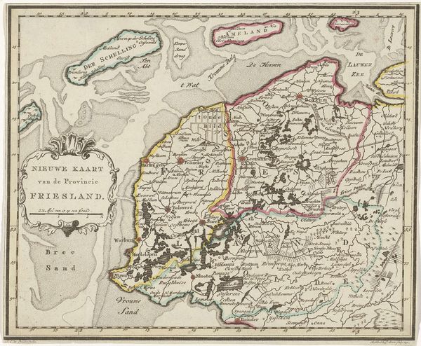
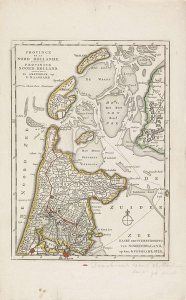
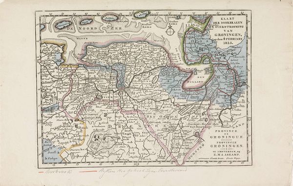
Kaart van het gebied in Friesland getroffen door de overstromingen in 1825 1825
0:00
0:00
anonymous
Rijksmuseum
print, engraving
#
neoclacissism
#
dutch-golden-age
# print
#
old engraving style
#
landscape
#
engraving
#
realism
Dimensions: height 178 mm, width 247 mm
Copyright: Rijks Museum: Open Domain
This map shows the area in Friesland affected by the floods of February 1825. It was made anonymously at the time of this immense natural disaster. What does it mean to represent the devastation caused by the breach? The map becomes a document of suffering, marking the profound impact on the lives and livelihoods of countless people. Notice how the flooded areas are depicted in a stark blue, contrasting sharply with the land. This isn’t just about geography; it’s a visual representation of loss and vulnerability. The flood didn't discriminate, yet its impact was felt most acutely by those with the fewest resources. It throws into sharp relief the complex interplay between nature, society, and the uneven distribution of risk. This map asks us to consider our place in the world, and our relationship with the environment, and it compels us to think about who is most vulnerable when disaster strikes.
Comments
No comments
Be the first to comment and join the conversation on the ultimate creative platform.
More like this