drawing, ink
#
drawing
#
landscape
#
etching
#
ink
#
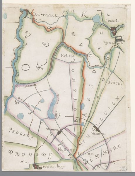
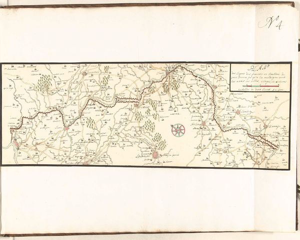
watercolour illustration
Dimensions: height 125 mm, width 98 mm
Copyright: Rijks Museum: Open Domain
Editor: This is "Ex libris van Louis Ring," a drawing in ink and watercolour that some believe dates from 1881 to 1936. The landscape has a muted and antiquated feel. The level of detail is very compelling to me; it evokes a sense of adventure, like an old treasure map. What really strikes you when you look at it? Curator: Treasure maps! Yes, I can totally see that, and I love how your imagination jumped right there. For me, seeing a work like this pulls me into thinking about time and perspective, you know? How someone, back whenever this was created, understood their world, how they navigated it. I find a deep sort of meditative quality here. Do you notice how every element, every tiny mark, holds significance? Each structure suggests untold stories about community. How would you even *begin* to interpret it as something other than just a landscape? Editor: Well, besides just seeing it as a landscape, I think the inclusion of cities and geographical features could maybe reflect the region's culture at the time. It's very practical, like the art serves a logistical purpose, rather than strictly aesthetic. Is that off base? Curator: Not at all. The relationship between practicality and aesthetics...it’s a constant conversation isn’t it? This blending of art and utility – do you think it diminishes either, or elevates them both? What is “art,” really? Just asking that question is a treasure in itself. Editor: I’ve never thought of it that way; that asking the question is its own reward! Maybe that's the true purpose of art. Thanks! Curator: Absolutely! Sometimes a work simply sparks the right question in us at the right moment, and its real value lies in that. I’ve learned a thing or two from you, so thanks.
Comments
No comments
Be the first to comment and join the conversation on the ultimate creative platform.
More like this