#
comic strip sketch
#
pen sketch
#
sketch book
#
personal sketchbook
#
sketchwork
#
pen-ink sketch
#
pen work
#
sketchbook drawing
#
storyboard and sketchbook work
#
sketchbook art
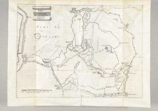
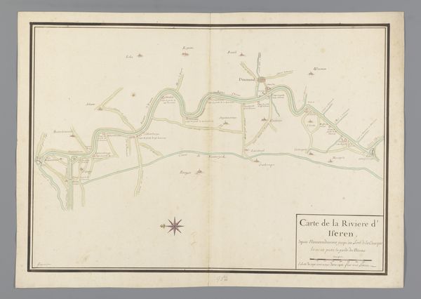
Dimensions: height 170 mm, width 461 mm
Copyright: Rijks Museum: Open Domain
Editor: Here we have "Kaart van de Franse linie in Brabant," or "Map of the French Line in Brabant," from around 1705, created by J. van Gort. It looks like it’s pen and ink on paper. It's fascinating to see such a detailed record of what I assume is a military line. What kind of symbols do you recognize here? Curator: This map vibrates with the weight of cultural memory. Look closely: beyond a geographic representation, we see an ideological landscape taking shape. The winding line itself, that fortified trace… What do you think it represents emotionally? Editor: Perhaps a sense of division, but also of protection? It seems quite definite and carefully drawn. Curator: Exactly. Consider the power a border holds. Throughout history, cartography has served not just navigation, but also nationalistic aims. How might the seemingly objective representation of geography subtly reinforce power structures? Editor: So, the act of mapping becomes an act of defining, even controlling, space and identity? The very style feels… assertive. Curator: Indeed. And look at the compass rose—more than a guide, it’s a symbol of navigation, exploration, domination. It evokes centuries of European expansion. The imagery subtly shapes our perception of this territory, doesn’t it? It quietly proclaims control. What emotions arise when considering this tension? Editor: I see your point! It is about establishing control. I had never thought about a map as having an emotional impact. Curator: Maps hold immense symbolic power! Reflect on how this cartographic representation shapes, reinforces, and perhaps even challenges our understanding of power, boundaries, and cultural identity. Editor: I will! Thank you for shedding a new light on cartography. I’ll definitely look at maps differently from now on!
Comments
No comments
Be the first to comment and join the conversation on the ultimate creative platform.
More like this