graphic-art, print, engraving
#
graphic-art
# print
#
geometric
#
genre-painting
#
engraving
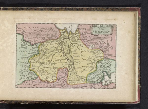
Dimensions: height 153 mm, width 223 mm
Copyright: Rijks Museum: Open Domain
Editor: So this is “Kaart van Namen,” an engraving dating from sometime between 1700 and 1735. It’s quite striking, with its detailed rendering of the region. What do you see in this piece, particularly in the context of its time? Curator: This isn’t just a map; it's a statement of power. Look at the intricate details and embellishments. Maps like this weren't merely for navigation; they were tools for claiming territory and solidifying dominance. Think about the implications: who had the power to commission and disseminate such a map, and what does that tell us about the control over knowledge and land at the time? Editor: That makes me wonder, who was this map *for*? Curator: Precisely! Maps served the interests of those in power – rulers, merchants, and the military. This map could have influenced military strategy, resource extraction, or even taxation. It’s crucial to consider how it shaped perceptions of the land and its people and enforced political control. Can we consider maps a form of propaganda? Editor: Absolutely! By emphasizing certain features or excluding others, they actively shape our understanding of space. Curator: Consider the map’s silences, too. Who is missing from this representation? What perspectives are marginalized or erased? Recognizing these absences allows us to challenge the map’s authority and expose its biases. This is an opportunity to address colonialism’s impact and its ongoing effects in society today. Editor: I never thought about maps that way. Curator: Seeing art, even maps, as enmeshed in power relations provides a framework for understanding social justice. Editor: I see that so clearly now. Thanks, I have a lot to think about!
Comments
No comments
Be the first to comment and join the conversation on the ultimate creative platform.
More like this