print, engraving
#
baroque
# print
#
landscape
#
geometric
#
cityscape
#
decorative-art
#
engraving
Dimensions: height 182 mm, width 258 mm
Copyright: Rijks Museum: Open Domain
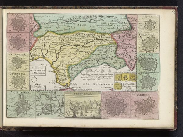
This map of Portugal and Algarve presents a fascinating study in early cartographic form. Composed with ink on paper, the map employs a medley of pastel hues – pinks, yellows, greens – to delineate regions, creating a visually appealing, yet informative tableau. Notice how the geographical accuracy gives way to aesthetic and symbolic representation. The use of star-shaped cartouches framing the periphery, each labeled with place names, lends a decorative quality, elevating the map beyond a mere functional tool. These motifs act as signifiers, indicative of cultural values embedded in its making. The lines meticulously trace rivers and borders, yet also hint at power dynamics and territorial claims. The composition directs our gaze, not just to geographical locations, but to the broader cultural and political landscape shaping the space. It serves as a reminder that maps are subjective constructs, imbued with meaning, inviting endless interpretation.
Comments
No comments
Be the first to comment and join the conversation on the ultimate creative platform.
More like this