coloured-pencil, print, paper
#
coloured-pencil
# print
#
landscape
#
paper
#
11_renaissance
#
coloured pencil
#
geometric
#
genre-painting
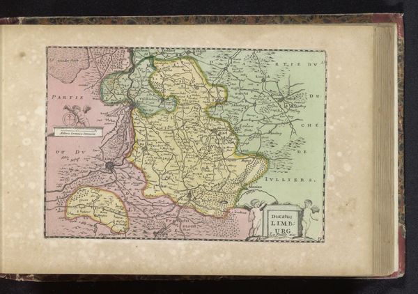
Dimensions: height 155 mm, width 235 mm
Copyright: Rijks Museum: Open Domain
This is an anonymous map of the Margraviate of Antwerp, made sometime in the past. The map presents a formal arrangement, with the territory divided into zones differentiated by distinct colors. Note how the meandering river creates a natural boundary, its course emphasized by yellow edging. This both divides and connects the landscape. Lines trace roads and boundaries, functioning as semiotic signifiers that structure the space. At the top left, a classical figure oversees the territory, a symbol of authority and governance. The map's formal structure emphasizes the tension between natural landscape and imposed order. The artist's choices—the delineation of space through color and line, the symbolic use of classical imagery—invite us to consider how power and knowledge are embedded in the very act of mapping. This artwork encourages us to reflect on how we perceive and represent space.
Comments
No comments
Be the first to comment and join the conversation on the ultimate creative platform.
More like this