drawing, print, paper, ink
#
drawing
#
baroque
# print
#
landscape
#
paper
#
ink
#
cityscape
#
genre-painting
#
watercolor
Dimensions: height 153 mm, width 229 mm
Copyright: Rijks Museum: Open Domain
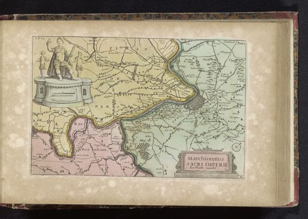
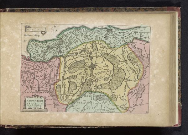
This anonymous map presents us with the dominion of Mechelen. The cherubic figures flanking the title tablet at the bottom are not merely decorative, but rather symbolic guardians. These figures evoke the classical tradition of Eros and Psyche, embodying love and the soul. Their presence here suggests more than a simple geographical representation. It's an invocation of the spirit of the place. Such cherubic figures remind us of their distant ancestors in ancient Roman art, where they adorned tombs, symbolizing the soul's journey. Over time, they reappeared in Renaissance paintings, evolving into symbols of divine love. Here, their appearance on a map suggests a deep, perhaps subconscious, desire to protect and cherish this territory. The map, therefore, transcends its practical function, engaging us on an emotional level, reminding us of the enduring human connection to the places we inhabit. It's a symbol that resurfaces through history, always carrying echoes of its past, yet adapting to new cultural landscapes.
Comments
No comments
Be the first to comment and join the conversation on the ultimate creative platform.
More like this