About this artwork
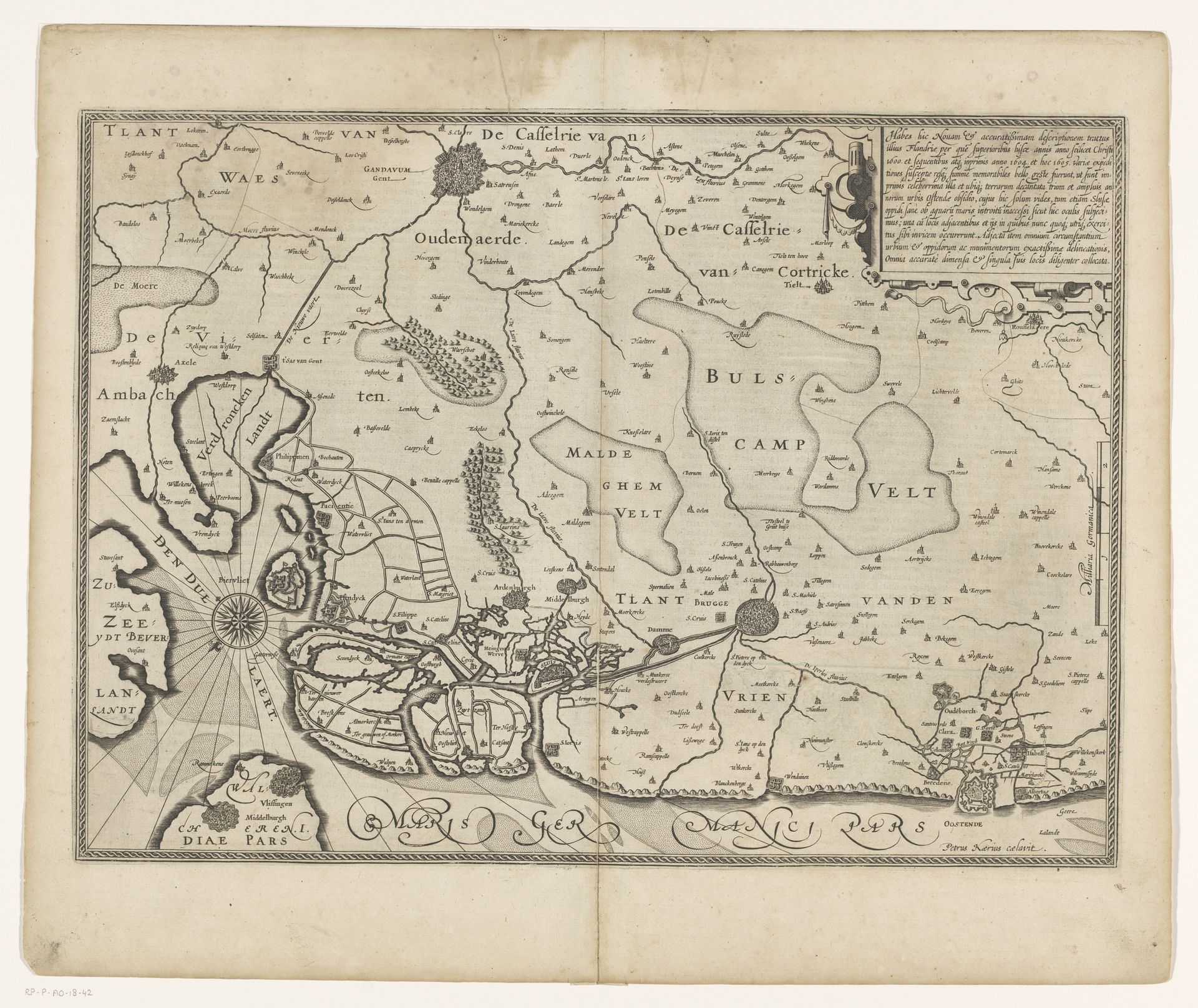
This map of West and Zeeland Flanders was made by Pieter van der Keere around the turn of the 17th century, using engraving. This process involves incising lines into a metal plate, applying ink so that it fills those recessed lines, and then transferring the image to paper with a press. Consider the many hands involved in this type of printmaking. Paper making was a highly skilled job, often using recycled textiles as a raw material. The engraver would have had to be deft with sharp tools, and have great attention to detail. Printing itself demanded strength and finesse. Maps like this one are fascinating because they show a geographical area but also assert control over it. They reflect the growth of trade and the desire for territorial domination, both key ingredients of early capitalism. They could be considered beautiful objects and also tools for resource extraction and colonial projects.
Kaart van West-Vlaanderen en Zeeuws-Vlaanderen 1611 - 1612
Pieter van der Keere
1571 - 1646Location
RijksmuseumArtwork details
- Medium
- print, etching
- Dimensions
- height 371 mm, width 513 mm
- Location
- Rijksmuseum
- Copyright
- Rijks Museum: Open Domain
Tags
dutch-golden-age
etching
landscape
Comments
No comments
About this artwork
This map of West and Zeeland Flanders was made by Pieter van der Keere around the turn of the 17th century, using engraving. This process involves incising lines into a metal plate, applying ink so that it fills those recessed lines, and then transferring the image to paper with a press. Consider the many hands involved in this type of printmaking. Paper making was a highly skilled job, often using recycled textiles as a raw material. The engraver would have had to be deft with sharp tools, and have great attention to detail. Printing itself demanded strength and finesse. Maps like this one are fascinating because they show a geographical area but also assert control over it. They reflect the growth of trade and the desire for territorial domination, both key ingredients of early capitalism. They could be considered beautiful objects and also tools for resource extraction and colonial projects.
Comments
No comments