1757 - 1777
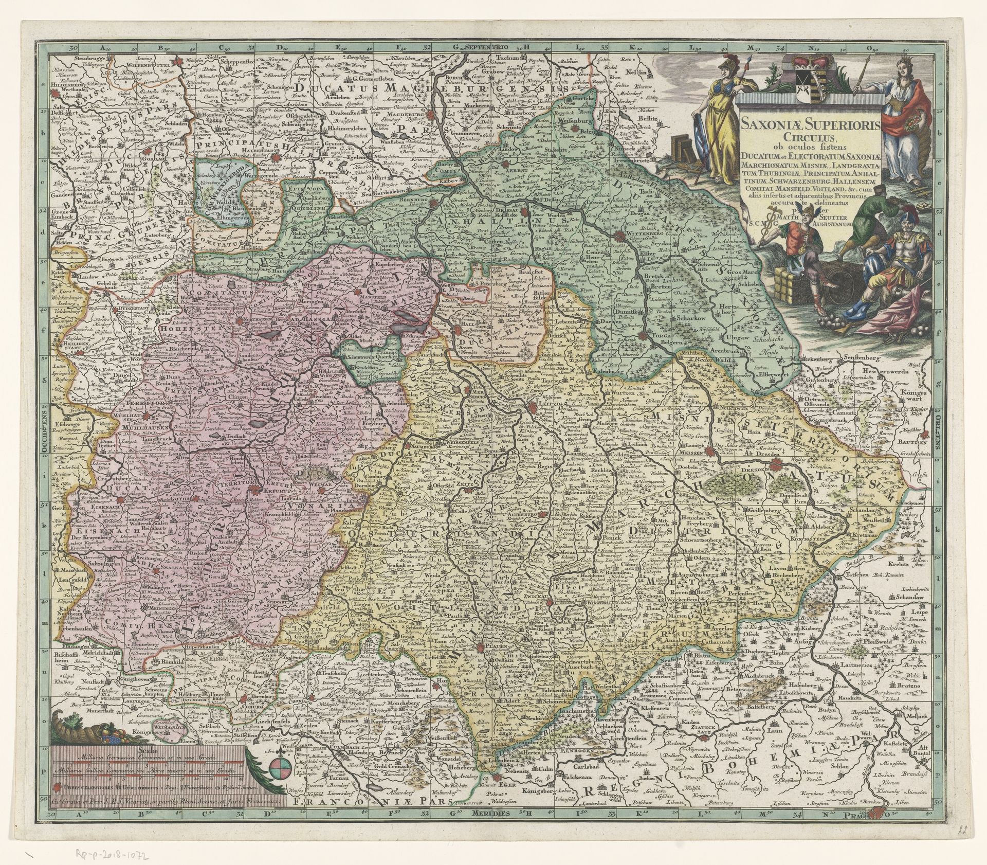
Kaart van het keurvorstendom Saksen
Listen to curator's interpretation
Curatorial notes
Curator: At first glance, this work strikes me as extraordinarily intricate, like peering into an ordered yet overwhelming world. It is a print called "Kaart van het keurvorstendom Saksen," dating from between 1757 and 1777. Editor: Yes, there’s definitely a powerful sense of order and control at play here, fitting the baroque aesthetic perfectly. Looking at it from the perspective of labor, though, the sheer number of inscriptions, and detail of each tree and building suggest immense, almost unbelievable time invested in production by a whole studio. How did they do it? Curator: Maps themselves have always served as much more than geographical documents; they’re imbued with political and symbolic power. Note how Saxony is rendered as a carefully tended garden—a claim to cultural and political authority as much as spatial accuracy. Consider those figures in the upper corner representing abundance and nobility, carefully observing the laying out of territory as a claim of superiority. Editor: And yet, that “garden” imagery belies the labor conditions and extractive industries likely underwriting such wealth. Who was literally moving the earth, consuming resources to build the fortresses and plant the crops being documented here? The map glorifies ownership, while hiding a history of hard labor. Curator: It’s true that these visual testaments to dominion rarely depict the true costs. However, there is something timeless in how geographic markers echo cultural understanding—those cityscapes, the arrangements of towns – they resonate still in modern geopolitical structures. The symbolism and visual organization has incredible lasting power. Editor: I think its strength lies in the precision and deliberate rendering, creating an illusion of omniscience and ultimate governance. That impression must have impacted how people consumed, travelled through, and utilized land, creating a relationship to the built environment different from the land itself. We must remember that printmaking changed society irrevocably and has impacted the conditions we have today. Curator: Well said, indeed. This exploration, to me, confirms how something so seemingly functional also works on deep psychological levels through symbolism. Editor: Indeed, and as this detailed engraving speaks to meticulous craftsmanship and political and economic systems, we can view a material testament to history itself.