drawing, print, engraving
#
drawing
# print
#
cityscape
#
history-painting
#
engraving
Dimensions: height 503 mm, width 583 mm
Copyright: Rijks Museum: Open Domain
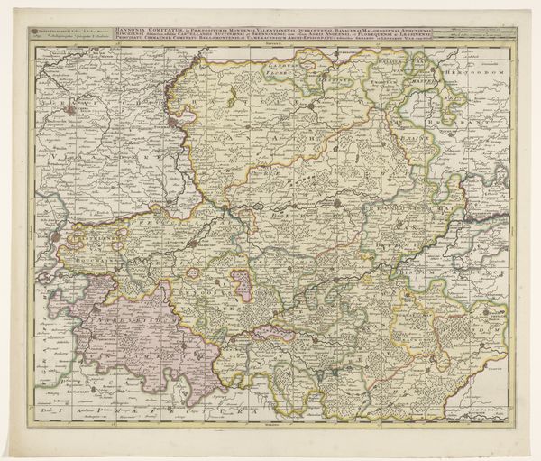
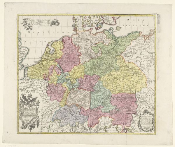
Curator: Looking at this map, my first thought is just how detailed it is. It’s a historical record, not just of geography, but of political power. The borders feel significant—not just lines, but dividing walls defining who’s in and who’s out. Editor: Exactly. We are observing "Kaart van het graafschap Henegouwen" (Map of the County of Hainaut), an engraving likely dating from the period 1691-1710, presently held at the Rijksmuseum. It provides insight into cartographic methods, but also into the early modern state and its ambition to codify space, resources, and therefore people. Curator: The decorative elements, like the cherubs, that almost make me think about what maps and their making mean in early modern Europe. They clearly indicate that map-making has never been purely about technical skill and utility. They project power, influence, and even cultural values. The act of cartography is deeply connected to ideas of colonialism and domination. Editor: Yes, and I'm particularly struck by the level of detail achieved through engraving. You can practically trace the tools and the labor that went into carving these intricate lines and lettering. This wasn’t some mechanical reproduction. There was skill and planning at the heart of it. The printing press was the means through which information was starting to become so quickly spread, but here one can focus on the means of engraving, and the role this played as a sort of labour in those workshops that created imagery like this. Curator: Thinking about the circulation of images like this, there's always a question of who gets to see, interpret, and utilize the knowledge held within. Whose perspectives are privileged? Who has the access, who does not? Editor: Precisely. It begs to ask whose understanding is codified versus suppressed through that circulation, particularly by such complex images made through skillful production. The layers are not always immediate, but they resonate with considerations we continue to deal with today around geographical knowledge and the politics embedded in cartography. Curator: This piece really underscores the multifaceted ways in which art and social commentary intersect. It highlights both material reality and symbolic interpretation. Editor: For me, reflecting on how this county has changed over time encourages examination of shifting relationships and power dynamics. Thinking about that material reality makes us question not just what we are seeing, but the labour embedded in creating these lines and the social contexts through which information comes to life in images such as this.
Comments
No comments
Be the first to comment and join the conversation on the ultimate creative platform.
More like this