drawing, print, etching, paper, ink
#
pen and ink
#
drawing
#
baroque
# print
#
etching
#
paper
#
ink
#
cityscape
#
history-painting
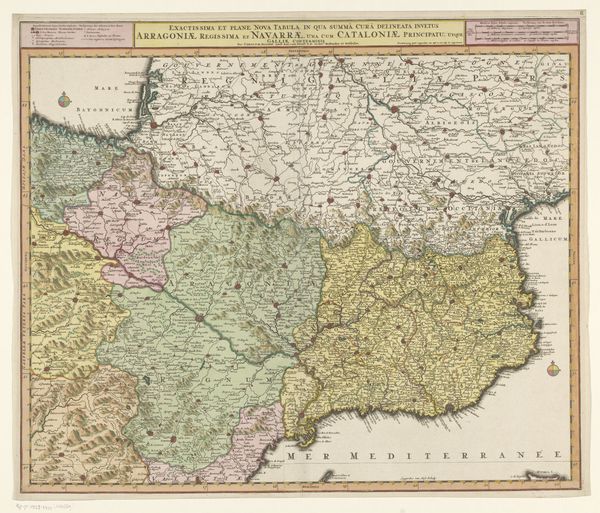
Dimensions: height 512 mm, width 603 mm
Copyright: Rijks Museum: Open Domain
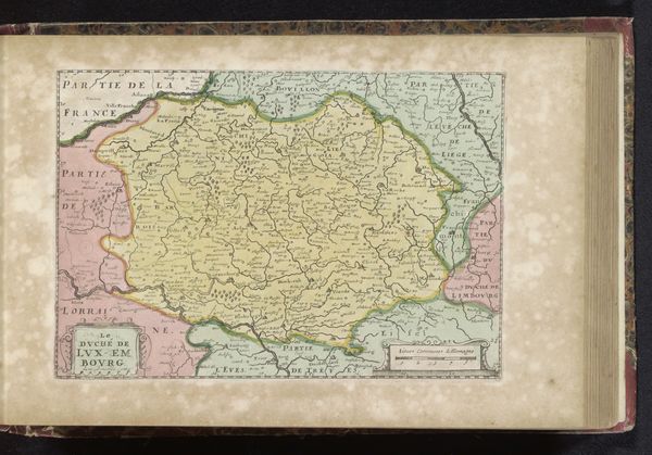
Curator: Let's consider this fascinating "Kaart van Catalonië," created between 1685 and 1711. It's a composite piece—a drawing, etched and printed—currently held here at the Rijksmuseum. Editor: My first impression? An almost overwhelming amount of detail, contained by clean lines. It strikes me as incredibly meticulous, almost lovingly rendered despite its likely practical purpose. It makes me feel like someone deeply cared about the places being depicted. Curator: Indeed. Maps from this era served many roles: practical guides, expressions of power, and even propaganda. This particular map was published during a period of intense conflict—the War of the Spanish Succession. Knowing it's titled in French "Theatre de la Guerre en Espagne," or Theater of War in Spain makes me want to know how it influenced public opinion in Amsterdam at the time. Editor: Well, if we examine some of the imagery—the elaborate cartouches bearing heraldic symbols, for instance—they clearly delineate territories and affiliations, reinforcing ideas of dominion and allegiance, visual declarations in the conflict's power dynamics. Do you see any repeated icons that stand out to you? Curator: Yes, and I’m curious how those choices shaped understandings of Catalonia among its Dutch viewers. Maps aren't neutral, of course. Even an anonymous artist's rendering reflected the political context, the publisher's interest, and Amsterdam's place within European trade and warfare. It subtly highlights the power dynamics that were influencing daily lives. Editor: That's a good point. Beyond the politics, though, the craftsmanship also communicates values. The inclusion of meticulously rendered cityscapes almost transforms it into a kind of portraiture of place. Even now, one feels a pull towards these cities depicted. Curator: Exactly, we could consider these places through the cultural institutions. I imagine people, decades later, finding new meanings, understanding what's different and the same, between Amsterdam and Spain, in relationship to places that influence power in their world. Editor: Ultimately, a detailed mirror reflecting not just geography, but also a moment in time, and power dynamics, carefully etched into paper. Curator: An artwork that invites us to explore the layered landscapes of history and perception, a testament to how cartography blends art, power, and propaganda.
Comments
No comments
Be the first to comment and join the conversation on the ultimate creative platform.
More like this