painting, watercolor
#
baroque
#
painting
#
landscape
#
watercolor
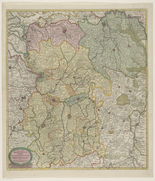
Dimensions: height 574 mm, width 487 mm
Copyright: Rijks Museum: Open Domain
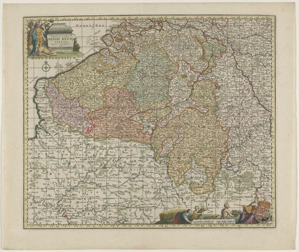
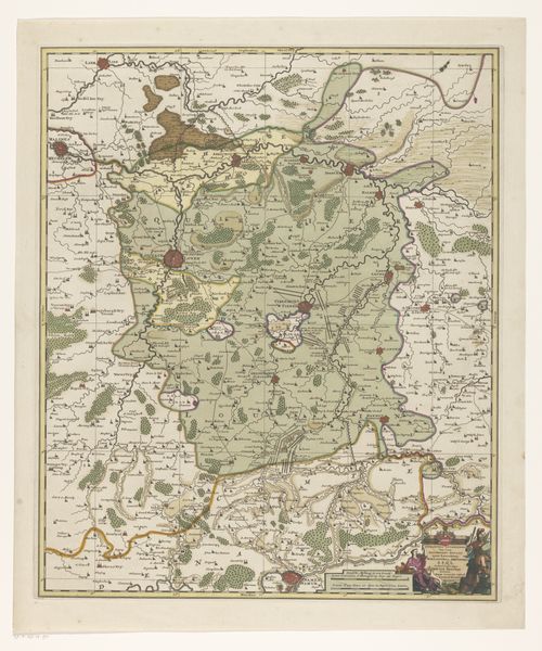
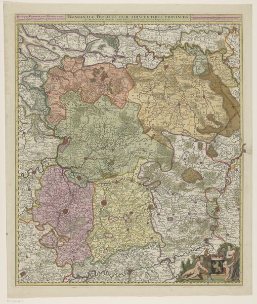
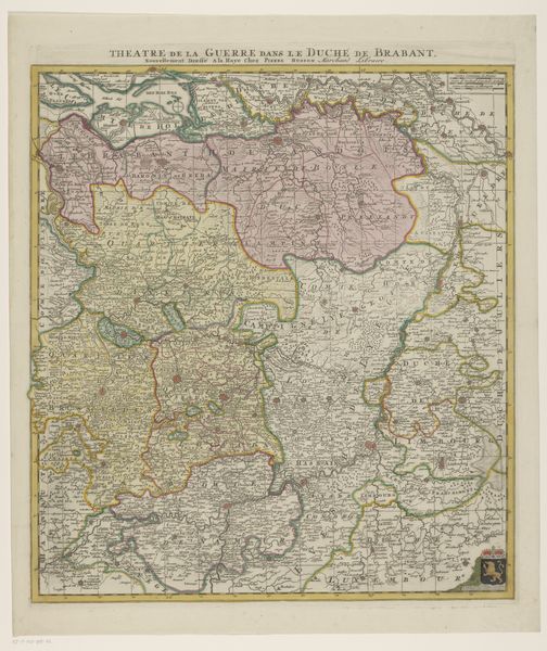
Curator: The meticulous detail immediately strikes me—a network of lines, colors, and tiny inscriptions forming the boundaries of the past. Editor: Indeed, this is a map of the Duchy of Brabant, created sometime between 1695 and 1711. Currently held in the Rijksmuseum, this piece employs both painting and watercolor to render not just geography, but a vision of power. The artist? Unknown, a common plight for artisans of this time. Curator: What is remarkable is not only the accurate, but aesthetic, rendering of landscape elements like rivers and forests. Semiotically, the differing colors delineate territories, while the ornamental cartouche speaks to baroque sensibilities, imbuing authority through classical allusion. It’s a persuasive image. Editor: But consider the physical labor, the paper making, pigment sourcing, and the deliberate division of labor within the workshop. The production reveals much about societal structure; even "Anonymous" was implicated in networks of patronage, participating in a commercial exchange. This map would serve strategic, propagandistic ends; it solidified claims over land. Curator: Yes, and materially speaking, look at the delicacy of watercolor! See how the chromatic unity blends geographical data and symbolic expression. These visual cues speak to Baroque drama and appeal to viewers with both an inclination to precision and grand imagination. The cartographer uses color and ornamentation strategically. Editor: We mustn’t ignore its function; such maps actively shaped colonial understanding, often distorting geographical reality in the process. These visual languages can, in turn, obscure exploitative economic practices by projecting an aesthetic surface. Consider how Baroque aesthetic intertwined in political power in the production of geographical knowledge, serving the agenda of authorities and wealthy patrons, becoming both artifact and instrument. Curator: Point taken. Looking again, it’s intriguing how aesthetic techniques could both serve and mask political ambition. Editor: Precisely, what seemed an objective record then becomes another object of interpretation. Let's keep these factors in mind to truly comprehend this work.
Comments
No comments
Be the first to comment and join the conversation on the ultimate creative platform.
More like this